Why I Went to Jasper- Part 2

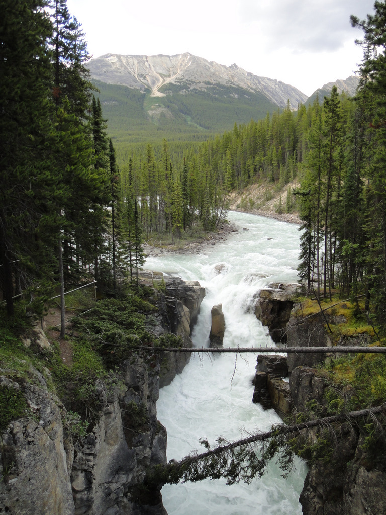
Maligne Canyon. The next day, I decided to take it easy: I would do a quick walk around downtown Jasper, complete a short hike, eat, drink coffee, and relax. For one, I was exhausted from Wilcox Pass. Secondly, the weather was scheduled to rain from mid-afternoon onward… which it did. When doing my research on attractions in Jasper, I came across 
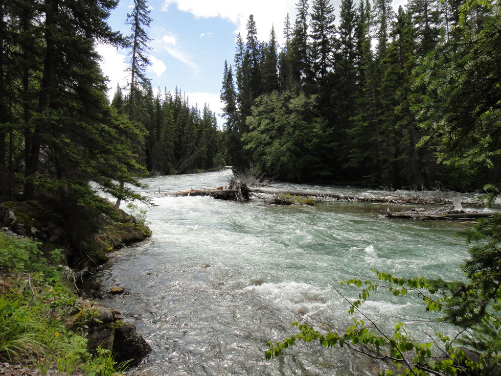
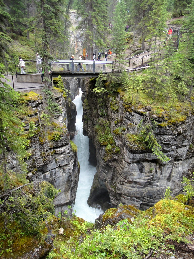
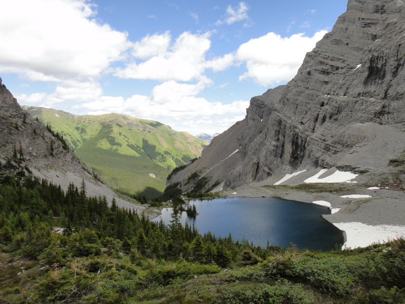
Maligne Canyon, which I think is the deepest canyon in the Canadian Rockies. I opted to hike to the canyon through the forest, mostly along the river, passing clear pools of water, and then hike back along the mountainside with a great view of Jasper and Pyramid Mountain. For me, the hiking was the best part, since the trails weren’t overly crowded, which made for some great thinking time. Maligne Canyon itself was quite pretty, with waterfalls and raging rivers. However, as I approached the main tourist section (i.e the main canyon, bridges, parking lot, gift shop, etc.), I realized that I don’t particularly enjoy hoards of tourists, so I took in the sights and was on my way. The rain began once I got back to the car, so the rest of the day was fairly uneventful… which was the best way to relax! I did manage to get a coffee and a sausage roll at Bear’s Paw Bakery. This bakery (and it’s second location) is pretty much THE place to get baked goods and coffee in Jasper… so good! Of course, the line-up is never fun :S.
Walking along Trail #7 toward Maligne Canyon 
Maligne Canyon. And the tourists (including me :S)

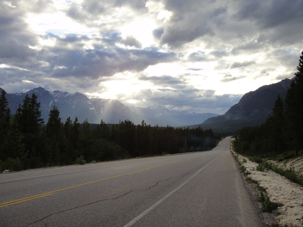
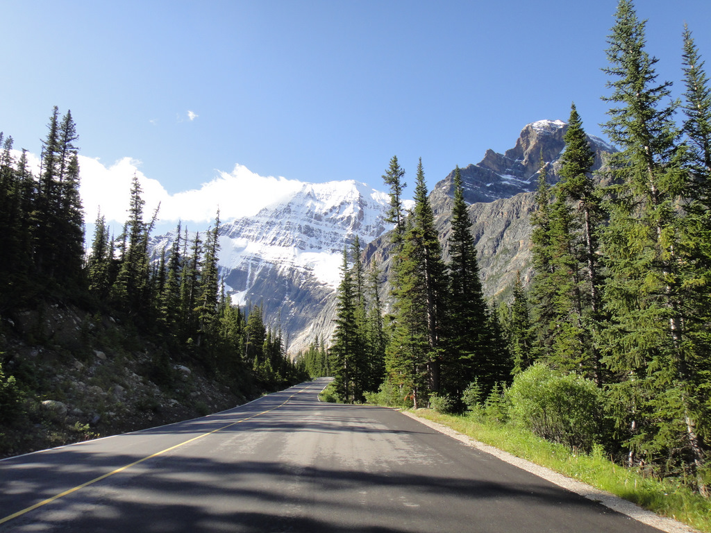
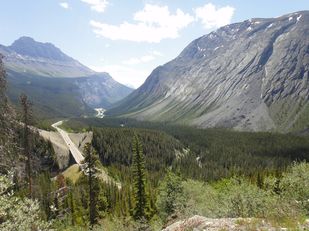
Mount Edith Cavell. On day 3, it was time to leave Jasper. I’m not sure when I’ll visit Jasper again, but I’ve learned never to say never, and to treat a ‘goodbye’ as ‘until next time’. That morning, I made another trip to Bear’s Paw Bakery for my must-have morning coffee, I filled up on gas and hit the road for the long trip back to Calgary. Of course, I’d be making stops along the way. The weather was absolutely gorgeous, so it would be a waste not to enjoy the Icefields Parkway as much as possible. Shortly after leaving, I noticed a turn-off indicating a lookout for “Mount Edith Cavell“. Alright, I thought, I’m going to go see that. After 5 km, I hit another turn off indicating it would be another 14 km to the lookout. It ended up being quite the detour from Highway 93, but the winding roads were very scenic, and I was able to see my first of two bears that day! (Thankfully, I only saw bears when I was in my car, and not while battling them face-to-face on a hiking trail!)

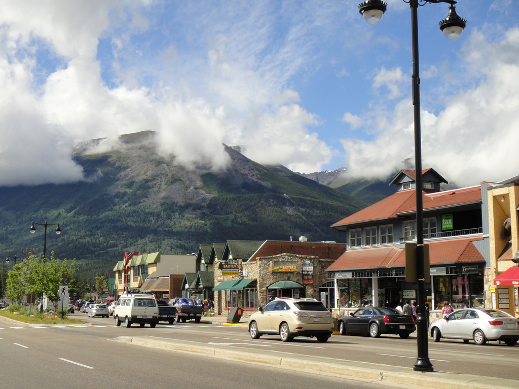
Downtown Jasper. Oh, the memories…
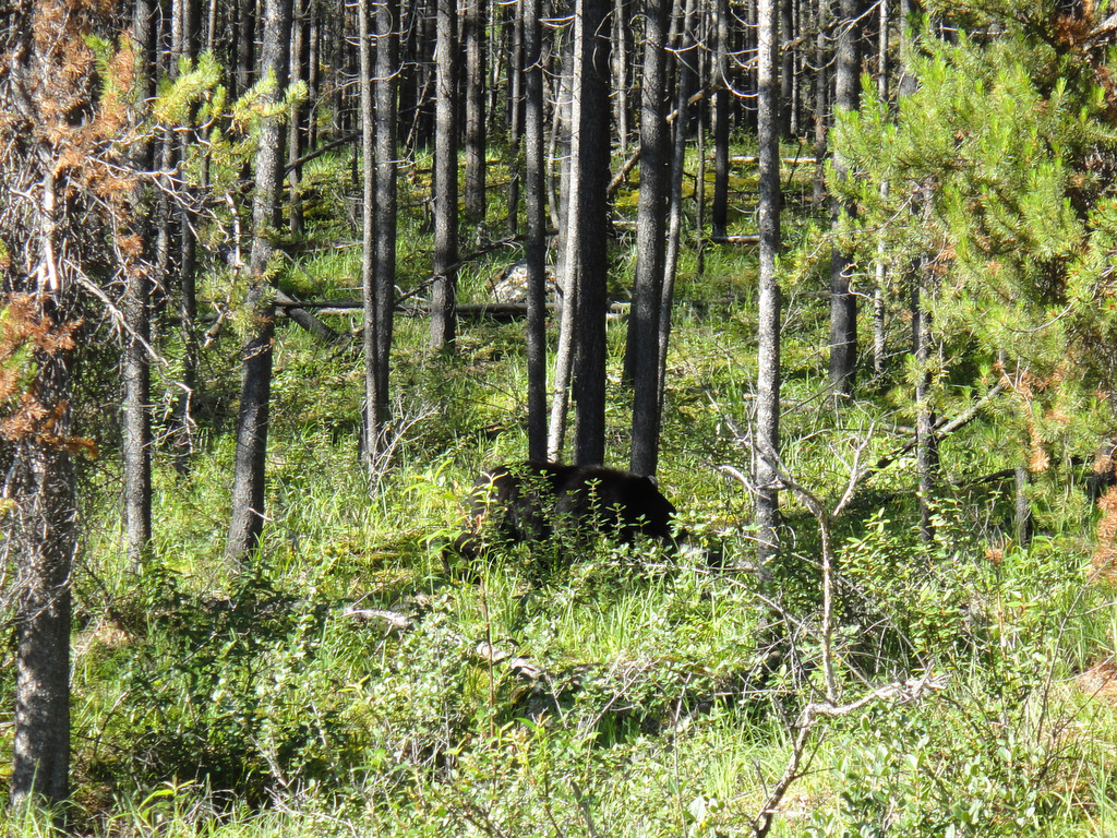
A bad photo of a bear. So cute. And so dangerous.
Approaching Mount Edith Cavell

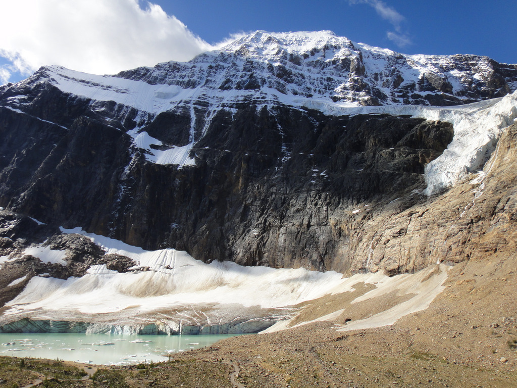
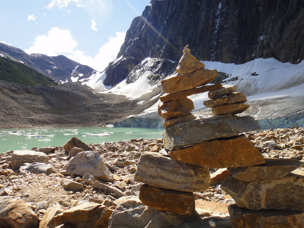
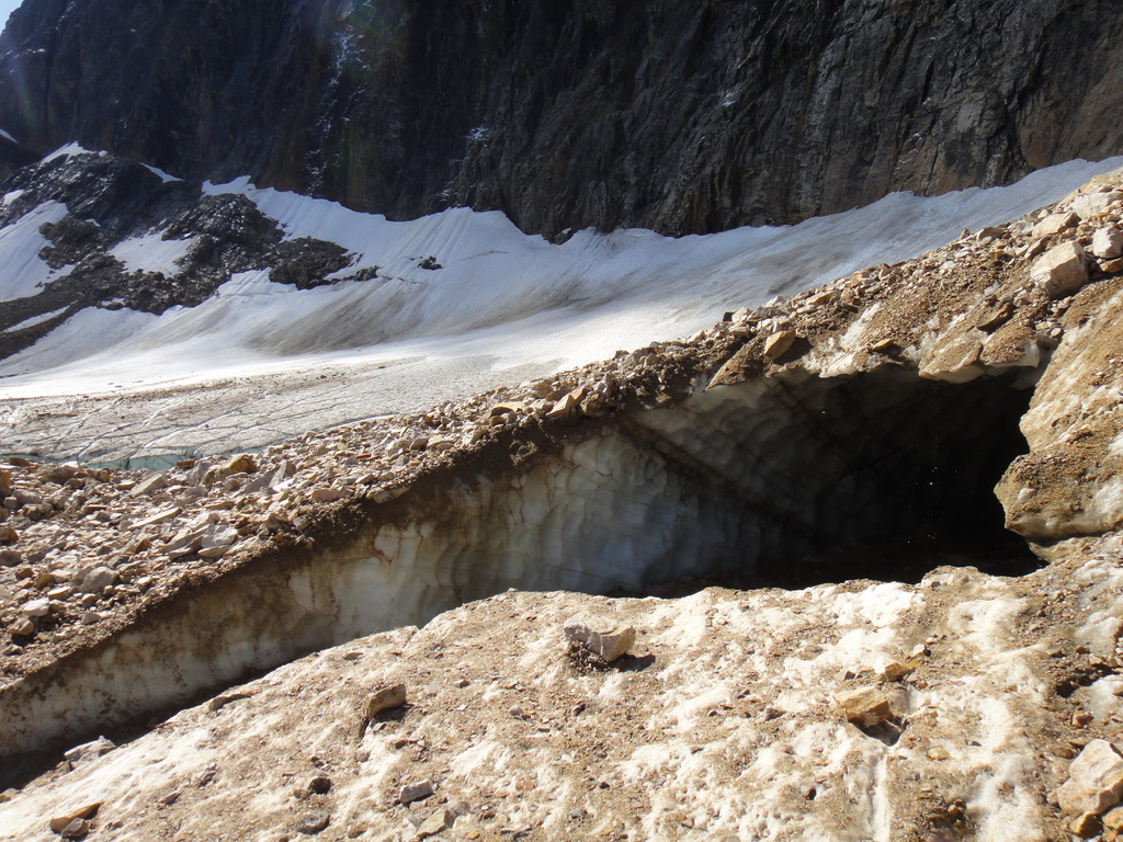
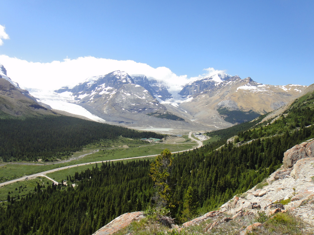
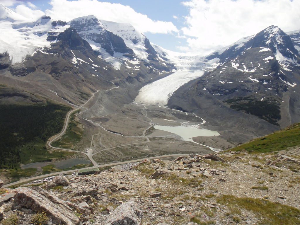
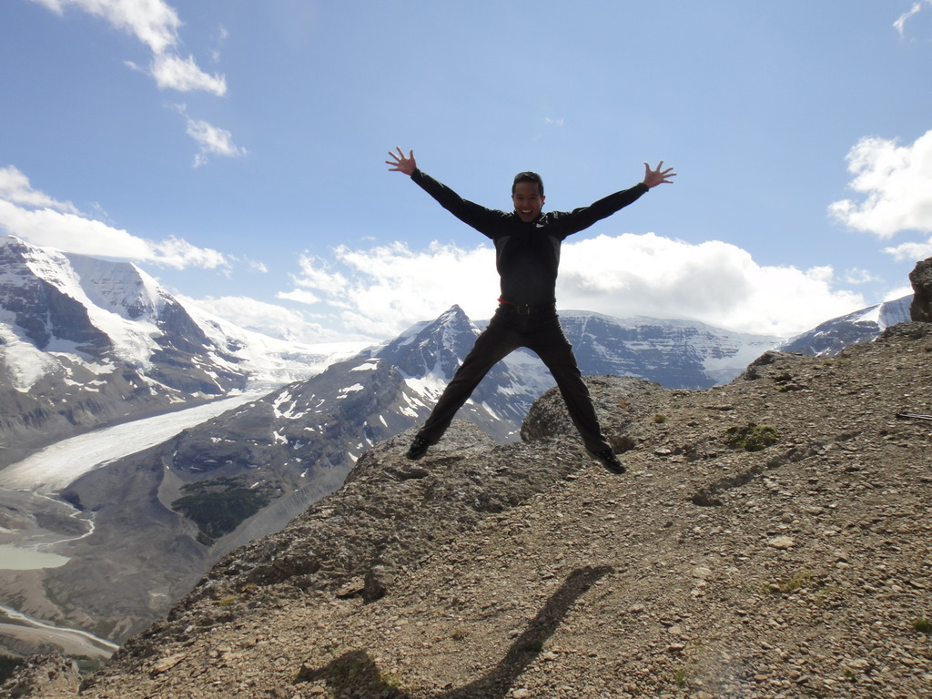
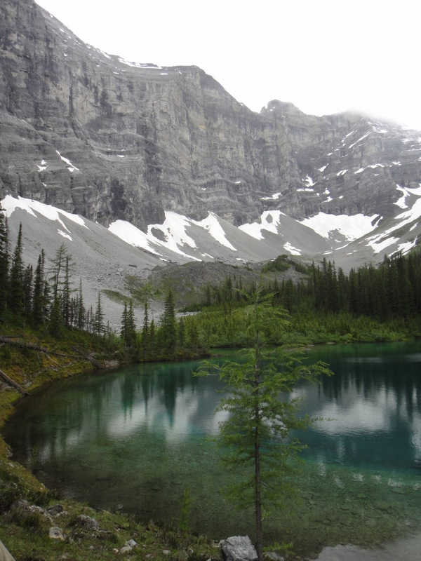
It was absolutely worth the detour. Approaching Mount Edith Cavell, with all her snow and majesty, was pretty incredible. After finding a parking space, there was a short hike along the Path of the Glacier Loop to a glacial pond at the base of the mountain where icebergs and ice caves were visible. The landscape was stunning. What I didn’t realize beforehand was that there would be two glaciers to see- Cavell Glacier and Angel Glacier. Mount Edith Cavell rises to an elevation of 3363 m and can receive quite a bit of snowfall, even in the summer months. I marvelled at the scenery, and after about an hour, it was time to hit the road once again…
Cavell Glacier (bottom left) and Angel Glacier (top right)
Icebergs in the glacial pond
Exploring an ice cave
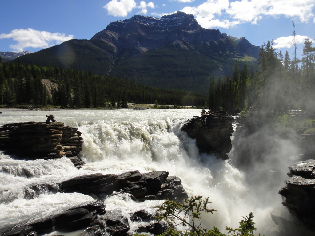
Athabasca Falls. Another 18 or so kilometres later… and after a second bear sighting… I arrived at Athabasca Falls. It’s a quick stop off the highway, which makes it another very busy place to visit. The daunting Mount Kerkeslin is poised over the raging falls, which I read is the most powerful waterfall in the Canadian Rockies. I basically ran in, navigated through some people, took a few photos, and was out of there and back on the road in no time. It’s definitely worth a stop :).
The Athabasca Falls and Mount Kerkeslin
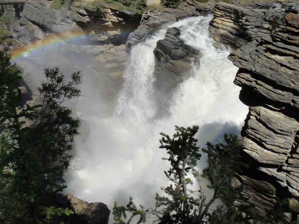
Rainbows are so pretty!
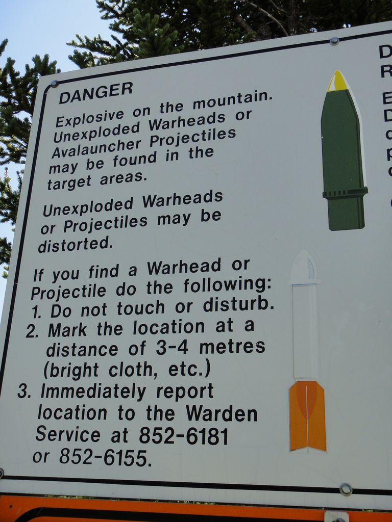
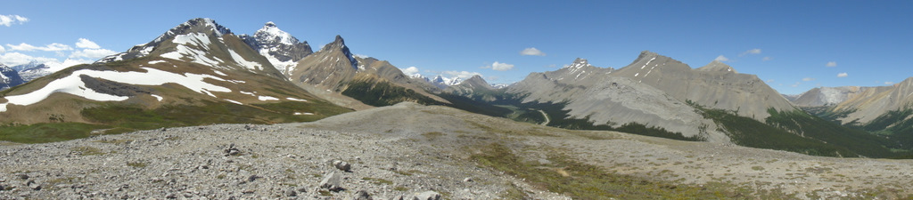
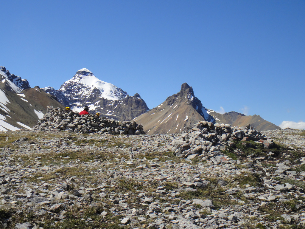
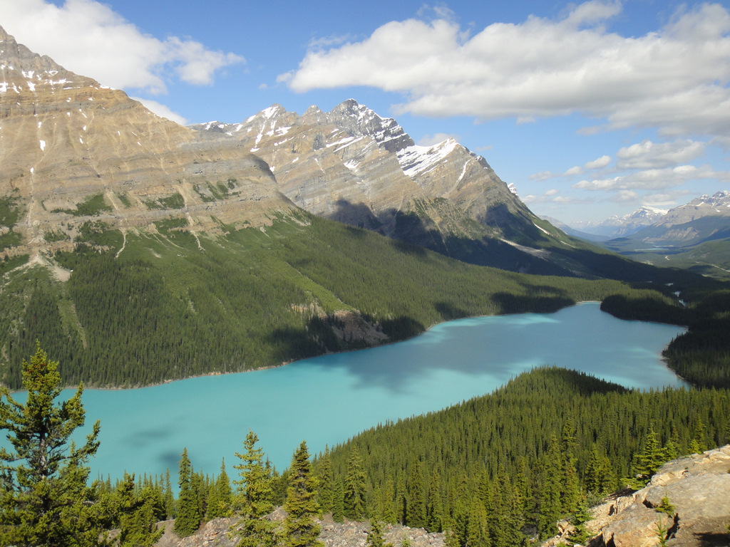
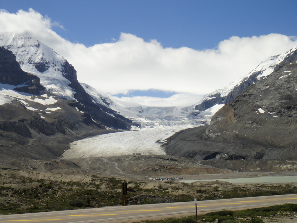
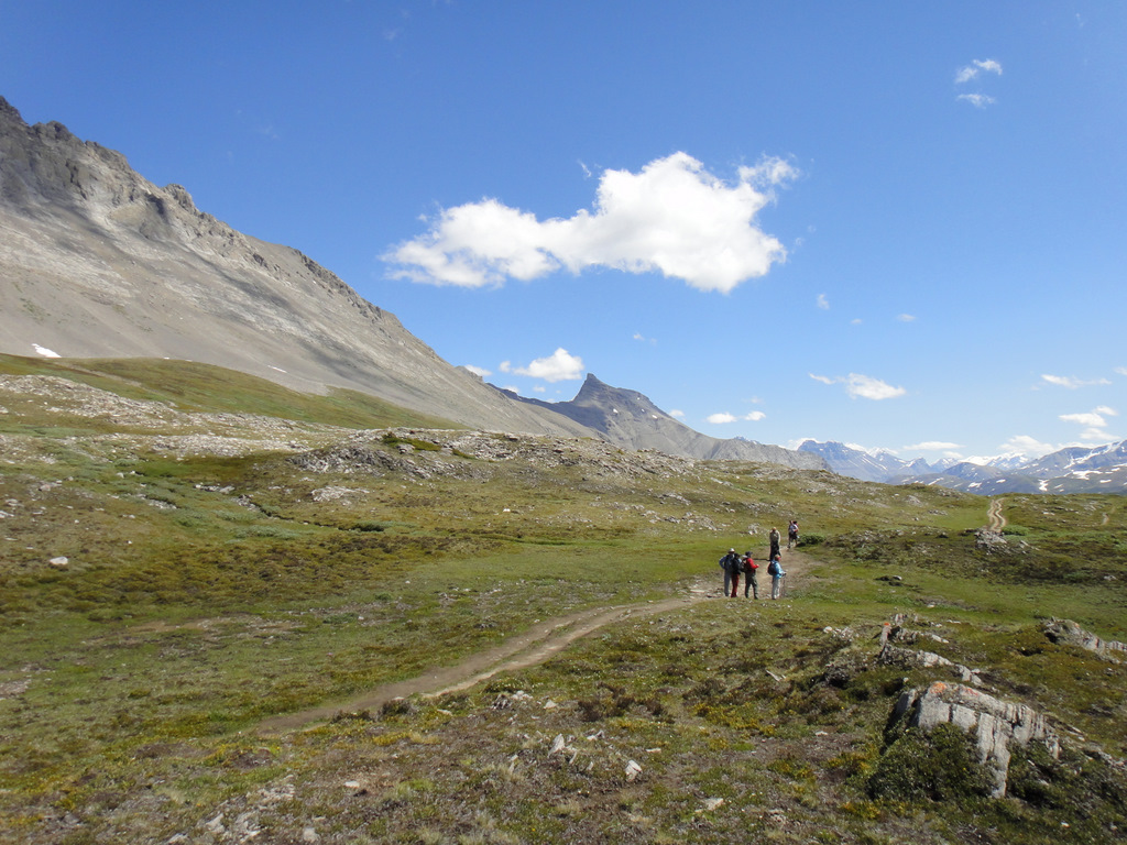
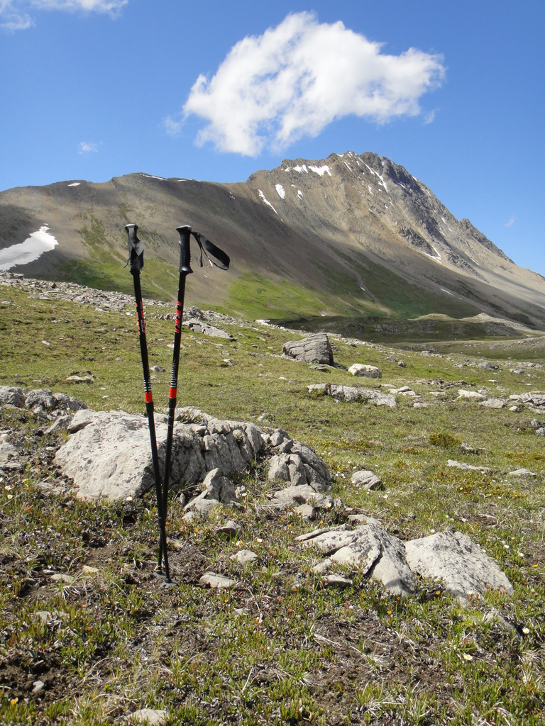
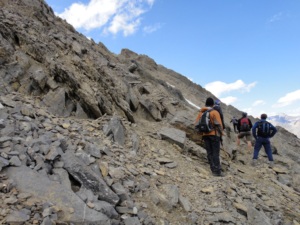
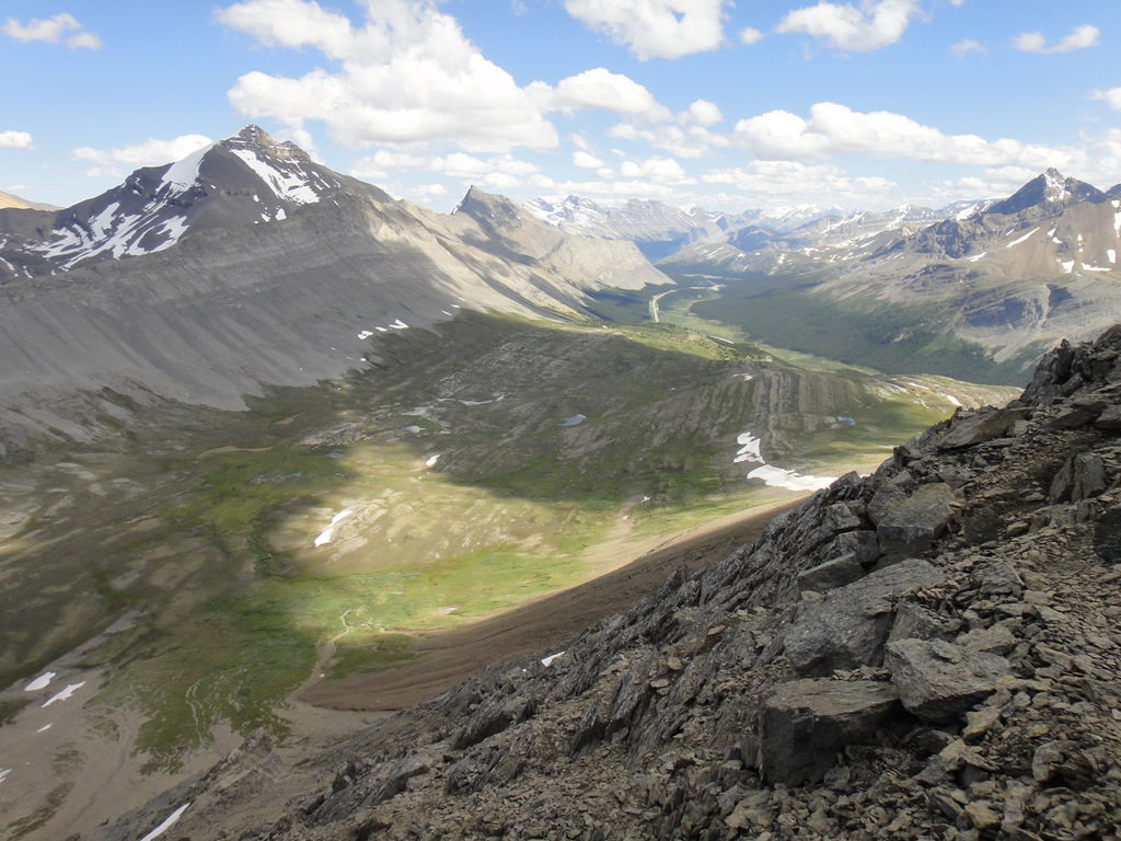
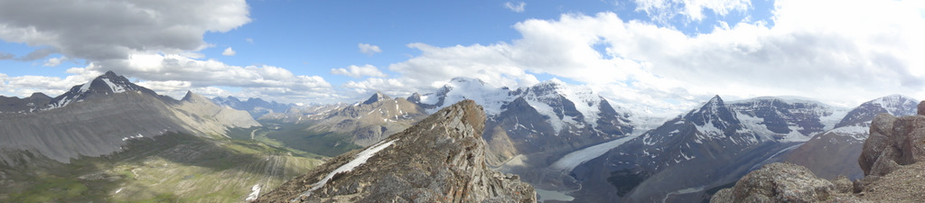
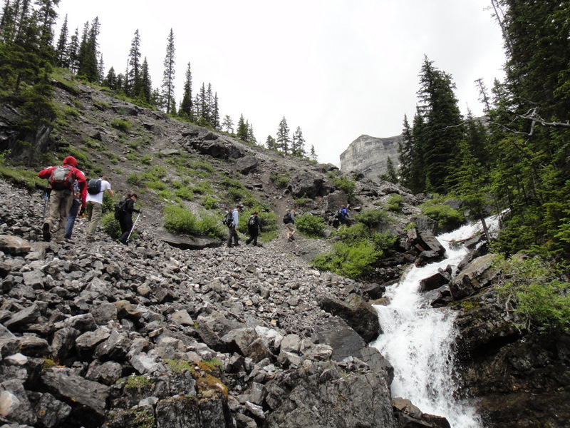
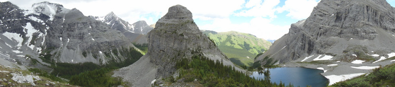
Parker Ridge.  In addition to reflecting on the last ten years, I wanted my mini-escape to include at least two good hikes. Wilcox Pass was challenging, so I opted for an easier hike on the way back. About 9 km past the Icefield Centre is the parking lot for Parker Ridge. It’s a very popular hike in the summer. The trail is about 5 km return and is a very straightforward path with a series of switchbacks. The elevation gain is 250 m- so not nearly as high as Mount Wilcox, but still high enough for a good workout with some amazing views from the crest of the ridge. From the ridge, you can see several huge peaks surrounding you, as well as a great view of the Saskatchewan Glacier. So it may not be the tallest ridge to summit, but the views more than make up for it. 
This is an interesting sign!
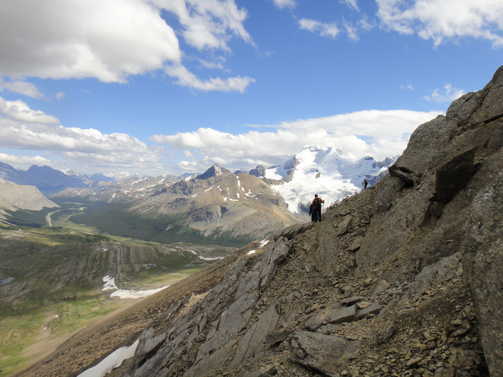
Hiking up Parker Ridge 
The ascent to the ridge
Luckily, I didn’t find any unexploded warheads. That would not have been good :S. The hike took me about one hour and forty minutes- 50 minutes up, some time wandering and taking photos from the ridge, and a sprint/trail run down that took about 18 minutes. At this point, it was about 3:30 pm, which meant I would make it back into Calgary at a decent time. I had a voracious appetite, so I quickly ate my awesome roast beef sandwich from Bear’s Paw Bakery, passed some bighorn sheep on the road, and drove the rest of the way home. I was tired, but incredibly happy about my adventure. It was just me, the road, the landscape and my thoughts. And lots of singing to Beyonce songs. Like, 3 days worth of singing to Beyonce songs.
View from the ridge
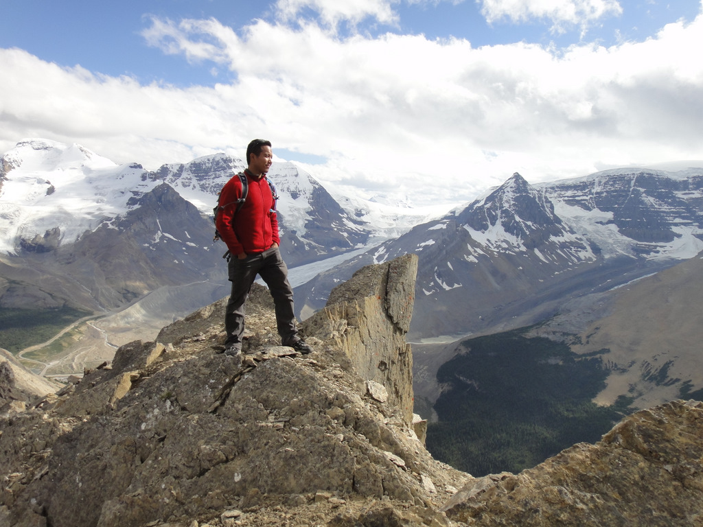
At the top of the ridge. It was so cold and windy!
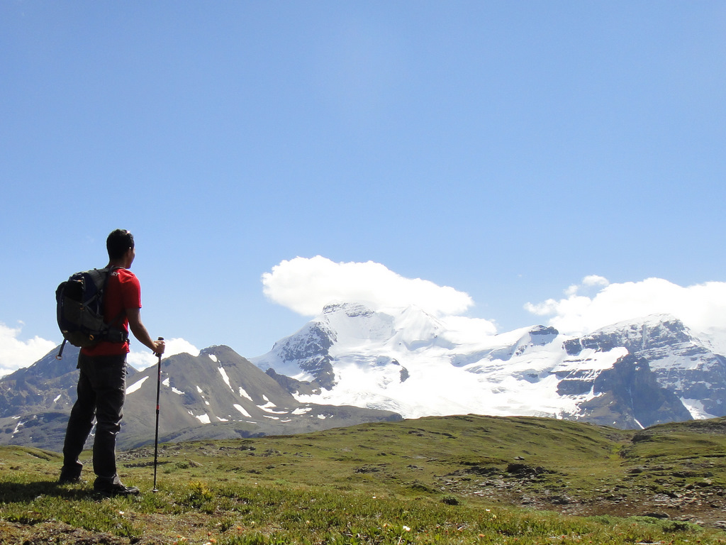
So what did I take away from all of this? Well, let me just say that the time I had to myself this past weekend was exactly what I needed. I mean, how often do we consciously decide to block off time for reflection? To have a few days to stop and think about my own progression over ten years is priceless. And not just over the last decade… but all of the choices I have made and experiences I have endured. They have all led to the man I am today. Of course, I also thought about what I want for my life in the many years to come, God spare my life.  There are many things I know about myself- the way I am, how I deal with certain situations, my expectations for myself and others, and how I view certain things around me and in the world. I have many capabilities and many short-comings. There are also things about myself I just don’t quite understand. This weekend allowed me the time and opportunity to think about these things. I had jotted down many notes over the three days with the intention to write a blog posting to help solidify my thoughts, but I realize that some will change as I change. Call it a work in progress. Truthfully though, I realize that I want to keep this part of the trip to myself. 🙂 There’s a lot of reflection time to sort through…

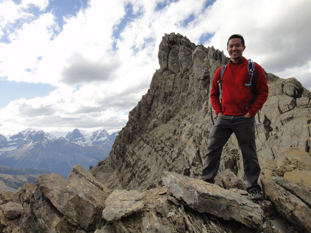
Being thinky and admiring the Saskatchewan Glacier

Why I Went to Jasper- Part 1

Revisiting Jasper. It’s been a long time…
The Reason. Right after completing my first year of university, I flew out to Jasper. My first year did not go so well and I left school with a sense of failure, as well as confusion about who I was and what I wanted to do. It sounds cliché to say that I wanted to find myself, but maybe that’s what I was doing. I found a job posting on the internet for a position at the Athabasca Hotel in Jasper, and after a quick phone interview, I was offered a job and I accepted. Shortly afterward, I boarded a plane to Edmonton, took a bus to Jasper, and lived in the dungeon… um… I mean staff quarters… provided by the hotel while working as part of the housekeeping staff. Needless to say, if I wanted to figure things out, this was not the solution. Although Jasper was gorgeous, and seeing the Rockies for the first time was breathtaking, I was definitely running away from things, and it didn’t take a long time before coming to this realization. After only a few enjoyable weeks, I flew back home humbled and ready to figure things out, repair some relationships, and get back to the positive person I knew I was. That was 10 years ago, in 2001, shortly before turning 20. This thought alone is overwhelming to me and puts into perspective how quickly time has flown. When I created my list of 30 before 30, “Go to Jasper, AB” was never about just going to Jasper. The significance of revisiting here is much more, and it has been the solo retreat that I needed before ringing in the big 3-0. When I decided to make the trip on the long weekend before my birthday, I called up the Athabasca Hotel and reserved a room for two nights. I figured this would be an interesting way to reflect on the last decade; to see what I remembered about Jasper and the hotel, and to think about how I’ve changed over the years. I guess in some way it feels like a journey through my twenties that has now come full circle. 2001 was one of the most difficult years for me personally. When I left Alberta then, little did I know I would end up living in Alberta 10 years later with so many opportunities to experience life and love in ways I couldn’t dream about at the time. 
Driving along the Icefields Parkway
To Jasper. The plan was to drive to Jasper and back along the Icefields Parkway (Highway 93) while stopping to complete some hikes and admire the natural landscape. I was very much looking forward to driving along the Icefields Parkway- 230 km of protected scenery between Lake Louise and Jasper, spanning both Banff and Jasper National Parks. It’s one of the most beautiful drives in the world. At 8:30 am Saturday morning, I set off for Jasper with a loaded car- clothes for 3 days, lots of food and snacks, hiking gear, coffee, and of course, Beyonce’s new album “4”. Yes, there is nothing like belting out a Beyonce song when it’s just you and the road. And for the number of times the album has been on repeat, you’d think I’d know all the words by now. Trust me- my loud singing in the car proves otherwise. On Saturday, the weather was predicted to be fantastic and sunny for the whole day, so I was looking forward to whatever came my way. 
Peyto Lake
Peyto Lake. After a few hours of driving, the first stop was Peyto Lake, located about 40 km from Lake Louise along Hwy 93. In my brief research beforehand, I read that the view of the lake was pretty spectacular. I’m definitely glad I stopped. After about a 10 minute walk from the parking lot and a 30 metre elevation gain, I was at the viewing point. I’ve seen lakes this colour before, but their beauty never ceases to amaze me. It’s a pretty popular tourist stop and it was super busy. I can only take crowds for so long, so after admiring the lake for a few minutes, I was ready to hit the road. From there, the drive was pretty spectacular as I continued toward the Icefield Centre where I would attempt to hike Nigel Peak. 
View of the Athabasca Glacier from the Icefield Centre
Wilcox Pass

Wilcox Pass. I arrived at the Icefield Centre about 4 hours after leaving Calgary. I had hiked onto the Athabasca Glacier last year with some friends, and this time I would attempt to hike to Nigel Peak on the opposite side of the highway for some amazing views of the corridor and the Columbia Icefield. It was much later in the day than I thought it would be for the start of my hike, and after chatting with people at the information centre, I decided I would hike Wilcox Pass (a shorter hike) with the intention to summit Mount Wilcox. The peak is at an altitude of 2884 m, and the elevation gain for the hike is 900 m. There’s moderate scrambling via the southeast ridge, and the hike would take about 6 hours. I was a bit nervous for this hike, as it would be my first big solo hike, and you never know what could happen- breaking an ankle while scrambling, or being mauled by a bear. The latter outcome scares me the most, as running into bears is a definite possibility. An encounter with a grizzly bear while hiking solo is my nightmare, and if I survived it, I could only imagine how traumatic that would be! Another reason for hiking Wilcox Pass is that after a short hike through the forest you rise above the tree-line where the visibility is much better. The less time in the trees, the better my chances are for avoiding a bear! Luckily, I had borrowed some hiking poles and bear spray, so I was ready to go. 
Ascending to the pass
Admiring the view
Mount Wilcox: I will conquer you!
The funny thing about life is that you never know who you’re going to meet or run into. After about 1.5 hours of hiking to the pass on my own, I decided to ascend and scramble to the peak. A lady told me she had never seen someone hike to the peak before, but lo and behold, I was not the only one attempting to summit Mount Wilcox that afternoon. In fact, I ended up joining a group of people, made up of groups of people, who were all trying to reach the top. Among them: a couple from Calgary, one of them working at the Foothills Hospital as a nurse, and one who grew up in Oakville; a guy from Denver travelling along the mountain range on his own; and another older guy from Peace River who is training to climb K2, which I learned is one of the most dangerous mountains to climb (… for every 4 people who make it to the summit, 1 has died trying :S). Thing is, he has already climbed the seven summits (http://7summits.com/), which are the highest peaks of the seven continents: Killimanjaro, Denali, Elbrus, Aconcagua, Carstensz Pyramid, Vinson and Everest. He now wants to climb the second highest seven summits, which is where K2 falls. Talk about ambitious!
View of the Athabasca Glacier as we ascend Mount Wilcox
The usual 
The group following the trail to the peak
Not at the summit, but getting close
The coolest in the group was a guy Laurie and his daughter Natasha. Now who is Laurie? You can find his website here: http://www.laurieskreslet.com/. Laurie Skreslet is the first Canadian to summit Mount Everest, which he accomplished in 1982. That’s right- I hiked with this guy!… the first Canadian to climb Everest! And he was so cool :). His daughter was also taking photos and filming scenes in order to update his website, because it’s definitely a bit out of date. So what started out as a solo hike to the peak of Mount Wilcox turned into a great group hike, led by Laurie Skreslet, as he gave us pointers about creating cairns for other hikers, being too ambitious when it comes to scrambling, pacing a hike, and using judgement when it comes to safety and turning back. Let’s just say no one in the group second-guessed his advice when he recommended we turn around after hitting some snow patches just short of the peak. We may not have reached the summit, but we got pretty close, and the views were incredible regardless. By the time we returned to the base of the mountain, the hike was a little over 6 hours. I said my goodbyes, thanked everyone for a fantastic day of hiking, and was off to Jasper. 
Laurie Skreslet (right) and his daughter Natasha
View of the Wilcox Pass from Mount Wilcox
Scrambling along the side of Mount Wilcox
I’m happy to be here!
Panoramic view from close to the summit
Sunwapta Falls. At about 54 km before reaching Jasper, I made a quick stop to see Sunwapta Falls. There are lots of beautiful lakes, falls and canyons in the Rockies. The Sunwapta Falls was definitely worth seeing. 
Driving along the Icefields Parkway, approaching Jasper
Sunwapta Falls
Jasper and The Athabasca Hotel. Upon entering the town, I stopped to take a photo of the “Welcome to Jasper” sign. It was a long time coming, and with that, I was able to cross “Go to Jasper, AB” off the list. I can’t quite explain the feeling of driving down Patricia Street and pulling up to The Atha-B. The front of the hotel was very familiar; Jasper itself was familiar; yet, at the same time, it felt different. I mean, it was 10 years ago. I actually had feelings of being beside myself, for lack of a better expression. The town was beautiful like I remember, but busier, which was expected since it’s the long weekend. I remembered the small library where I would write e-mails, as well as Jasper the Bear located in downtown. When I checked-in and settled for the night, the staircase, the bar, and the hallway leading to the staff quarters all brought back memories. It was all too familiar and distant at the same time. It was a great and packed day, but the following day would be a bit more relaxing with time for reflection….
The Athabasca Hotel

Hiking to the Memorial Lakes

Memorial Lakes: The third lake

So rather than spend the first weekend post-Europe relaxing and catching up on sleep, I decided to do a crazy long hike with a hiking group! It seemed like a lot more fun than cleaning and buying groceries. The hike of choice for today was Memorial Lakes, located in Bow Valley Wildland Provincial Park in Kananaskis Country. I’m not sure what the elevation gain was, but the trail was 16 km, and we crossed 3 lakes. According to the plaque at the third lake, the “three mountain lakes have been named and dedicated to the memory of thirteen people who lost their lives in three aircraft accidents in Kananaskis Country in June 1986.” Overall, the hike was pretty gruelling :S, but well worth it! And after 7.5 hours of hiking, it was time to go home. A hot shower never felt so good… 🙂

Making the ascent
Making the ascent
Almost at the second lake at this point
The second lake. So beautiful :)
The second lake. So beautiful 🙂
Totally rocking the blue gloves, which I love for scrambles
Yay!
Yay!
“We’re happy to be here!”
Me and a fellow hiker
Memorial plaque
Memorial plaque
Part of the group that hiked all the way to the third lake. W00t!
Panorama at the third lake