Larches from the Tent Ridge Horseshoe

Woah!
Woah!

So this is the time in Rockies when the larch trees are at their most beautiful, turning shades of yellow in the late fall. During this time, many Calgarians will flock to the Larch Valley near Moraine Lake in Lake Louise. I had hiked there in 2010 and it’s spectacular. However, I had heard that two weekends ago, there was a crazy car line up to the Moraine Lake parking lot, where it was a one-in-one-out situation. Rather than attempt to fight the crowds, there were many suitable alternatives for a weekend hike.

One side of the ridge from a clearing
Tent Ridge Horseshoe

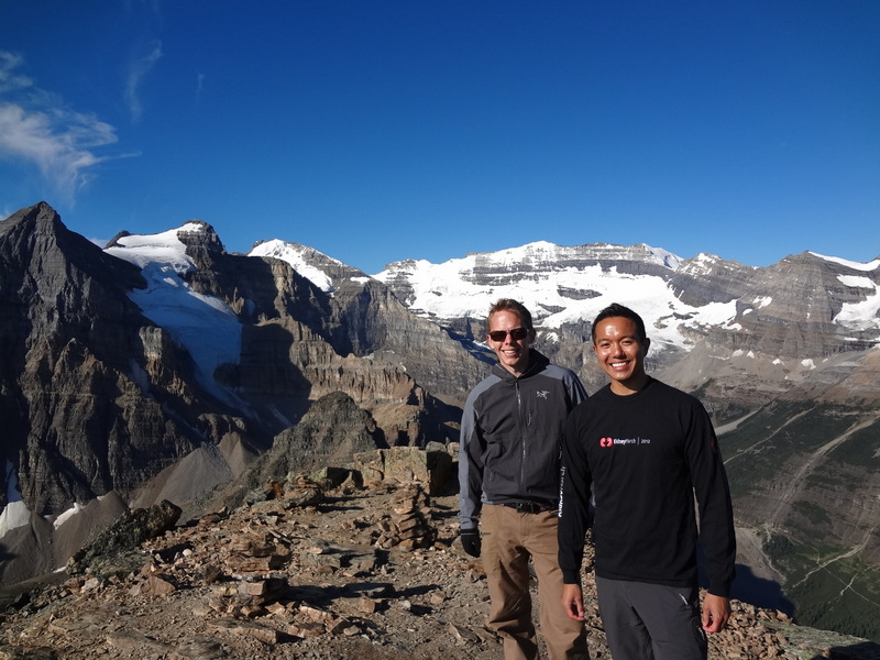
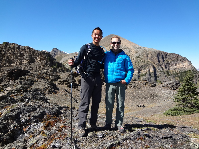
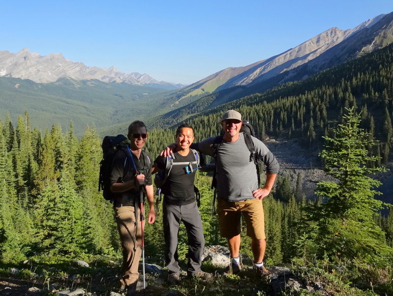
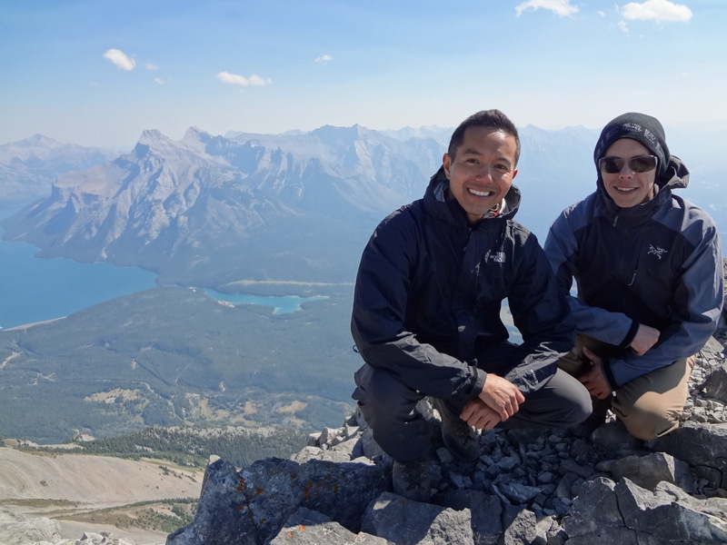
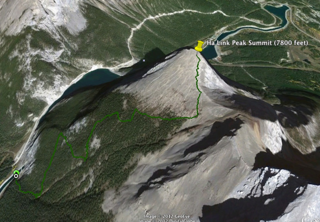
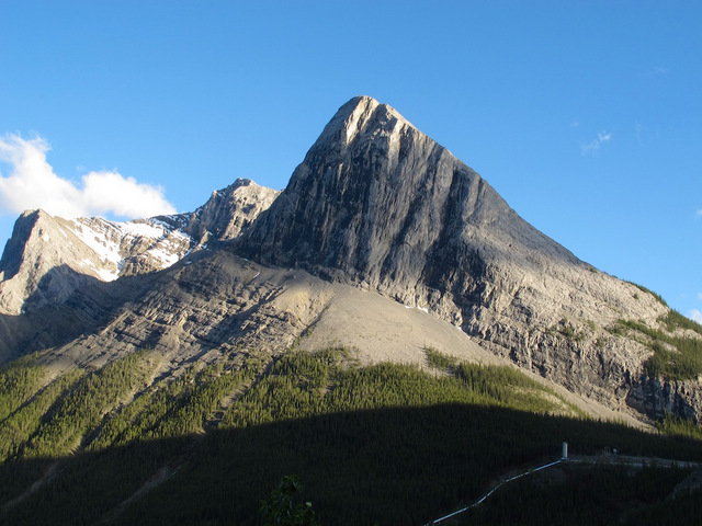
On Saturday, Robbie and I ventured out to Kananaskis. We decided we would find a hike that both of us had not completed. After hearing great things about Tent Ridge, we thought, why not do that one? From the Kananaskis Lakes turn off on Highway 40, we headed about 29 km north on the Smith Dorrien – Spray Trail (#742 South) to the Mount Engadine Lodge. The parking area was close to there.

Taking refuge beside a cliff for a quick lunch stop
Traversing the ridge. I love ridge walks!

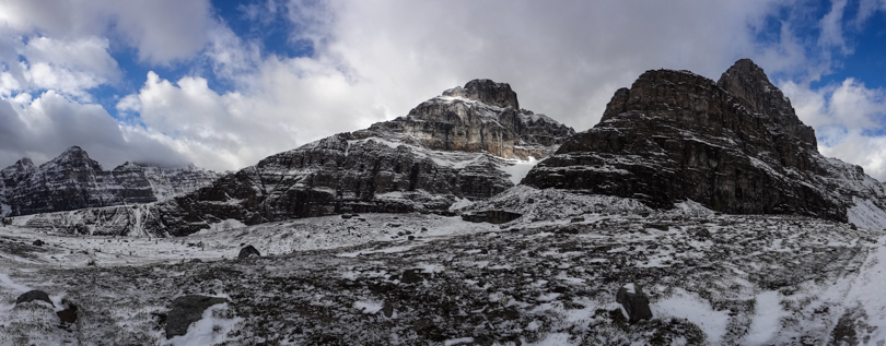
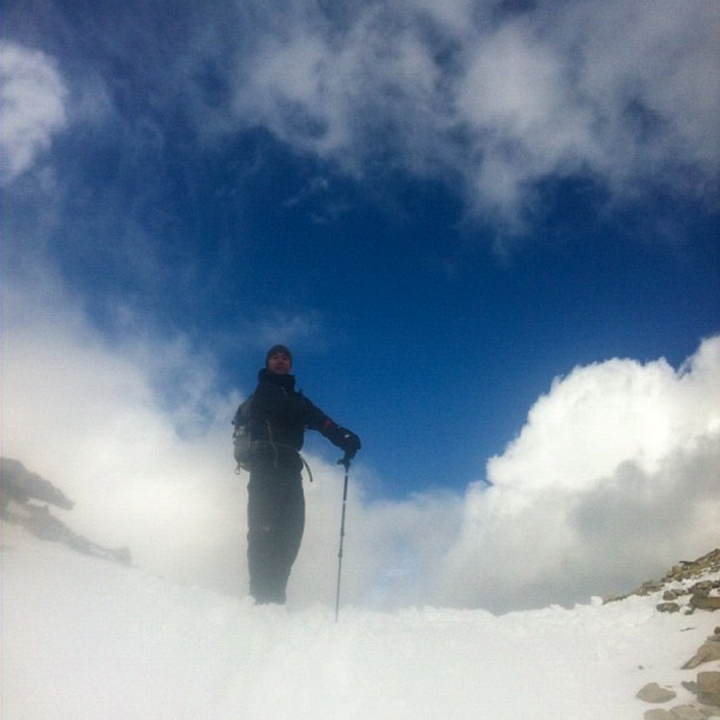
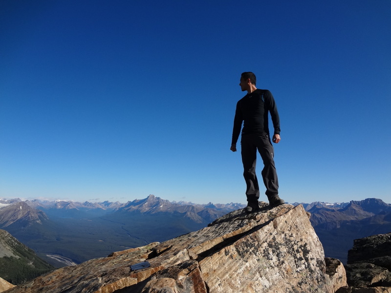
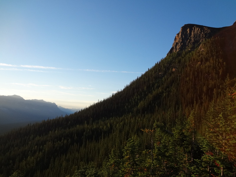
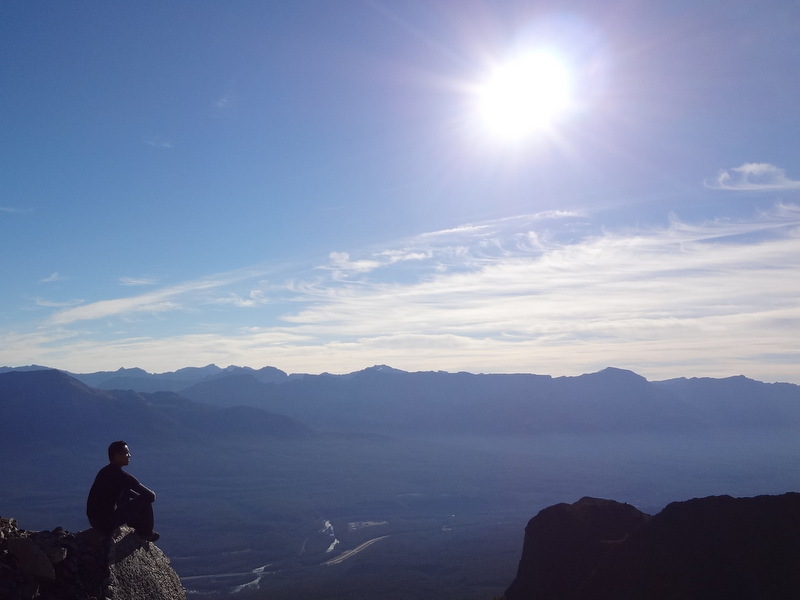
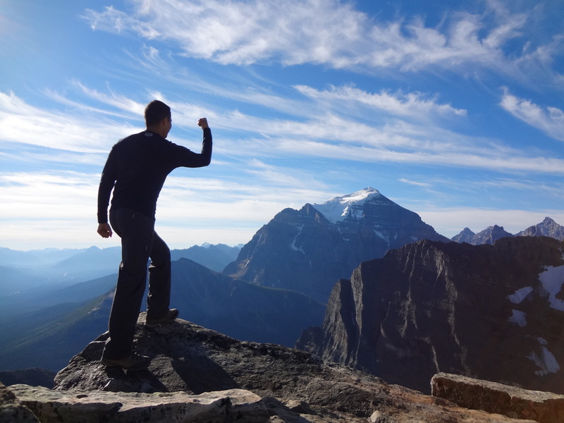
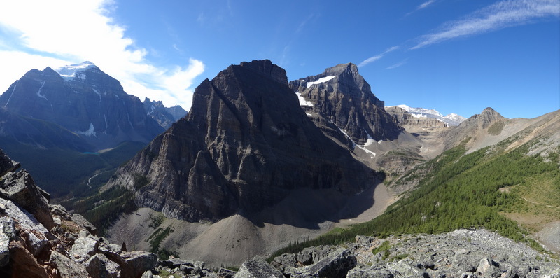
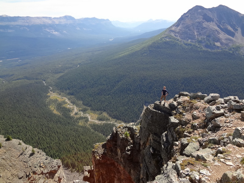
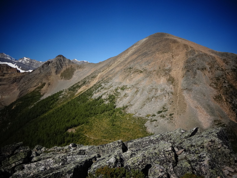
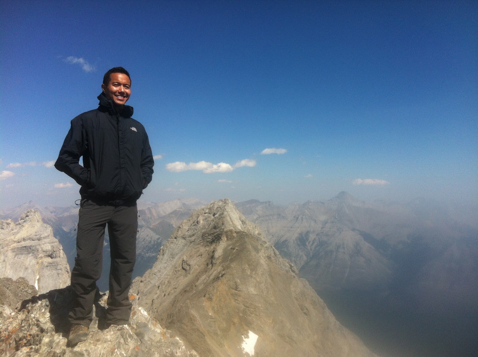
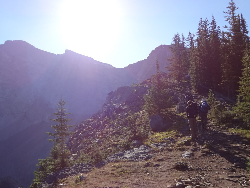
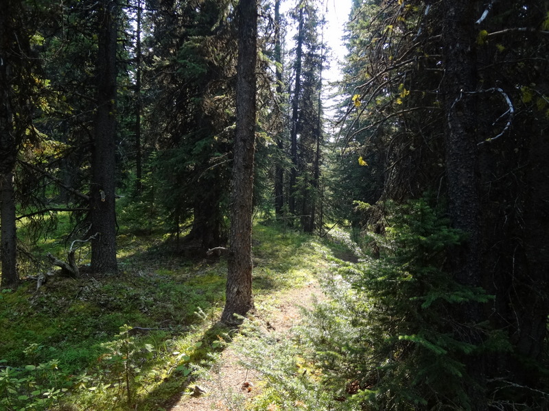
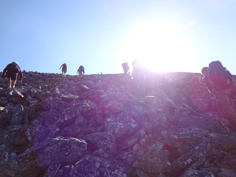
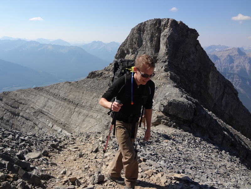
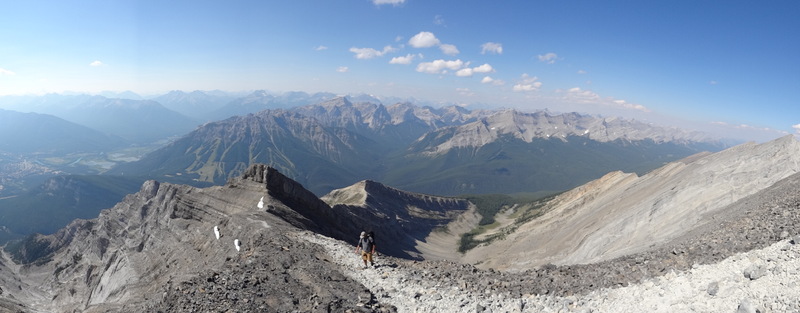
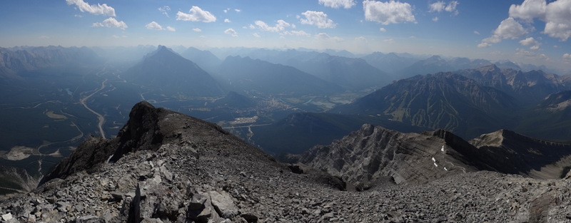
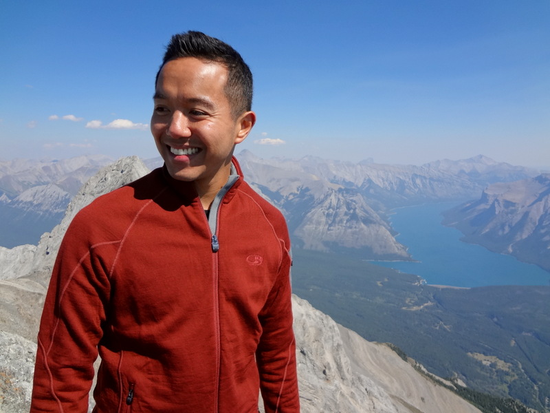
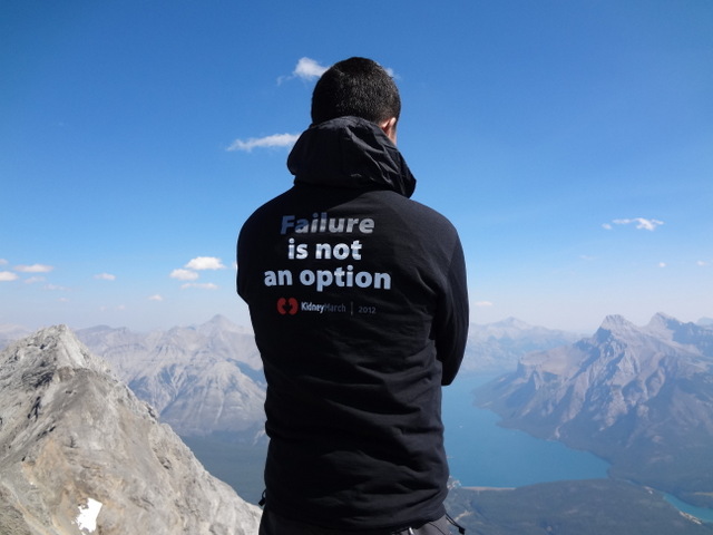
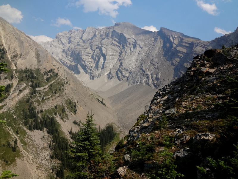
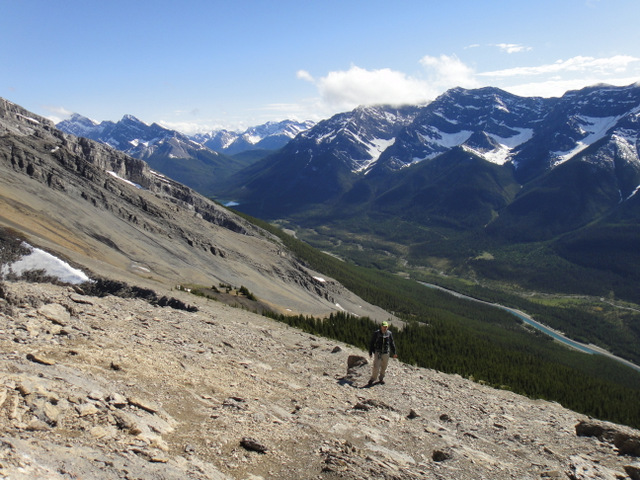
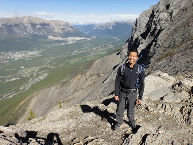
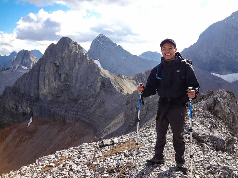
After searching for and finding the trailhead, it was a gradual ascent and then a steep slog to the clearing where we would begin climbing the mountain. The views were incredible every step of the way. There’s definitely no need to go to the Larch Valley to see larches! They were yellow and beautiful (though it’s slightly late in the season, so many of the leaves have fallen); there were mountain peaks all around us; and the Spray Lake Reservoir shimmered in the distance. The ridge is shaped like a horseshoe and has three summits, so there was a lot of variety throughout the day, including short sections of scrambling. The exposure wasn’t too bad at all, and it was all worth it to hike in the shadow of such peaks like Mount Smuts (2938 m) and The Fist (2630 m). Hopefully one day I’ll conquer those too…

Looking over the edge. Yikes!
I'm happy to be here!
I’m happy to be here!

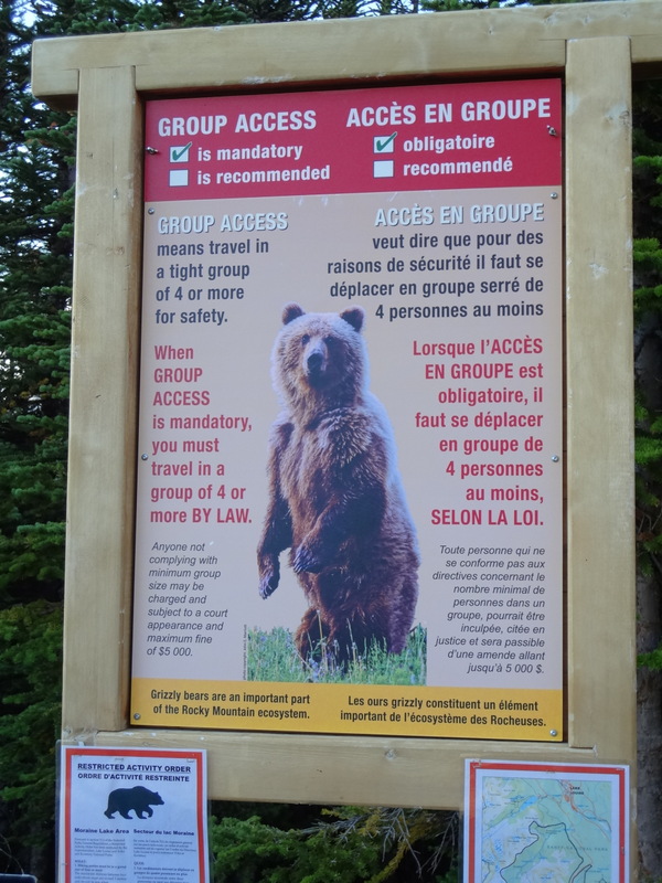
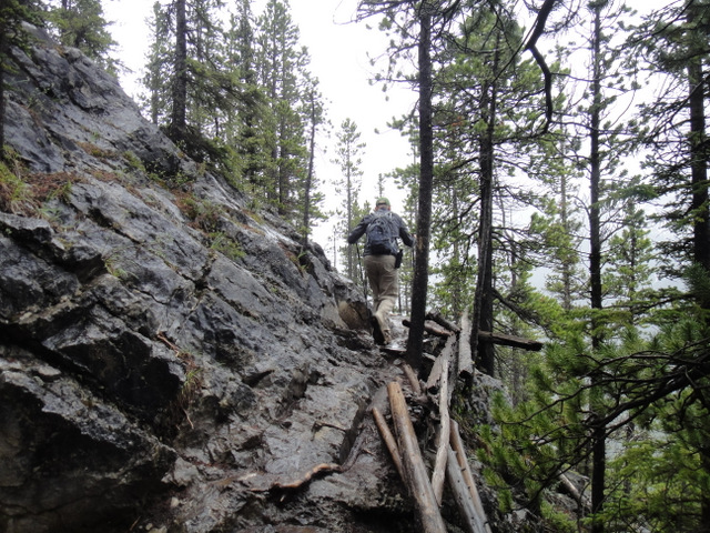
The descent was an interesting one. We somehow veered off the trail and ended up bushwhacking through dense forest to find it again. We knew we were going in the right direction, but with no clear path, we were nervous! The sun was beginning to set, so it was evening time in bear country… not a comforting thought. I think I may have even seen a bear dig at one point, which freaked me out even more. This hike, more than any other, had constant bear whoops and yells to keep the bears away. We even began running at times to speed things up. I acknowledge that we probably scared ourselves more than anything, but it definitely felt like a situation where show tunes wouldn’t have even helped :S. In the end, we made it to the car alive and well. NBD. What a fantastic day hike!

I have conquered this mountain!
View of the Spray Lake Reservoir from the summit

We were able to ascend the mountain, traverse the ridge, and get back to the car in 5 hours (12:40 pm – 5:40 pm; 11.5 km loop). According to one website I found, the highest point of the ridge is at about 2545 m, and the elevation gain is approximately 830 m (I think that’s cumulative). I don’t hike too many ridges, but I need to start adding more to the list. Hiking up one way and back down a different route is very cool! I should also add more Smith Dorrien peaks to the list. So many peaks. So little time…

Panoramic of the Tent Ridge Horseshoe
View from the summit. Amazing!

Eiffel Peak Will Do Just Fine

You win this round, Temple. Again.

Oh Mount Temple… how have you managed to elude me so?

On Wednesday, when the weather was all clear skies and perfect, we were unable to hike Temple due to bear restrictions. But Mount Temple stood like an incredible beauty. The snow that stood atop the mountain glistened in the sun. Gazing at Temple was as mesmerizing as listening to Beyonce belt out a ballad. But on Sunday, when we were slated to make attempt #2, Temple turned into its alter ego. A fresh snowfall the previous night added a complication to the hike. And the wind was fierce. Sasha Fierce. Would we be able to hike Mount Temple? Or was it untouchable like the unstoppable Sasha Fierce??

What’s that Jeff?? We’re hiking Temple?!?

To backtrack slightly, on Saturday while Dan and I were hiking the Tea House Highline Challenge, I received a call from Jeff from Banff Lake Louise Tourism and The Real Banff. He informed us that we’d be making another go at Mount Temple, and that our guide Joe from www.mountainguide.com would be at the Chateau for 5:30 am. Sweet! Since we needed a 4th, my good friend Paul made his way to Lake Louise, ready with all of his gear, and stoked to tackle Mount Temple!

Ready for Temple with a helmet, ice axe and crampons

The next morning, we left the Moraine Lake parking lot at 6:15 am and hiked through the Larch Valley. It was dark at the start, but as the light began to illuminate our surroundings, we quickly realized that it was a pretty special hiking area. In the fall, the Larch Valley is beautiful, especially when the larches turn a golden colour. Mount Temple, Mount Eiffel and Mount Pinnacle surround Eiffel Lake and the trail up to Sentinel Pass, so it was pretty awesome to see these gigantic peaks around us while we hiked. It snowed the night before, and so the trail was covered with a fresh blanket of snow. I’ve done the hike to Sentinel Pass before, but I’m always amazed how different the mountains look with snow. The clouds were dense the whole time, and it was windy! Mount Temple’s summit was hidden within the clouds. At over 3500 metres, it’s a beast!

Joe assessing the climb to the summit of Mount Temple
Paul, Dan and I at Eiffel Lake, before Sentinel Pass
A snowy hike up Sentinel Pass
View from Sentinel Pass

The hike up was a bit uneasy due to the snow, but we persevered onward. Once we arrived at Sentinel Pass, the wind was relentless.  But looking up at Mount Temple, the wind would be even more fierce. Sasha Fierce. That wind would be unforgiving for the next many many hours if we ascended. So we made the safety call to forgo Mount Temple, yet again. I’m okay with that. Safety first, folks! But Mount Temple has now elluded me a second time. Argh.

After Sentinel Pass, backtracking to start ascending Eiffel
Mount Eiffel (middle) and Mount Pinnacle (right)
Mount Eiffel, Mount Pinnacle, and cloud covered Mount Temple
A snowy scramble to the summit of Mount Eiffel

The day was not over yet. Instead, we would try to summit nearby Mount Eiffel. Once I looked up at Mount Eiffel from the lake, it seemed like a very acceptable alternative. It was epic! So off we went to make the ascent of snow covered Mount Eiffel. I’ve never hiked a mountain in that much snow before, but it was quite a fun day, and the scrambling near the top was awesome. Don’t get me wrong, we were pretty tired, having just hiked to the top of Sentinel Pass, but once we reached the top, the views were unlike other hikes I’ve done. All of the mountains around us were covered with snow, and Mount Temple loomed just an arm’s length away. By this time, the sun was shining through, and the view of Temple’s summit was now visible. I can only describe it as incredible.

Joe, Paul, me and Dan at the summit of Mount Eiffel
Panoramic from the summit
Panoramic with Mount Temple in view
Stopping for photos and lunch at the summit of Mount Eiffel
At the summit of Mount Eiffel. Temple totally photobombed my shot!

By the end of they day, we hiked to Sentinel Pass (elevation gain of 732 metres from the trailhead), turned back, bushwhacked to the start of the ridge to Mount Eiffel, reached the summit of Eiffel (3084 metres; elevation gain of 1230 metres from the trailhead), and navigated back through the Larch Valley as the snow melted. It was a very long hiking day of 10 hours. Despite the slips and wind and cold, it was most definitely worth every step!

“Gentlemen, we have conquered Mount Eiffel”
Making the long and slippery descent
Back at beautiful Moraine Lake after 10 hours of hiking

But it’s not over, Mount Temple. Mark my words. I can be Sasha Fierce too. You’ve been warned!

And speaking of Beyonce, it’s her birthday today, September 4th. She turns 31!

Fairview Mountain and Saddleback Mountain

At the top of Mount Fairview. It will do. Most definitely.


Yesterday when I went to bed, I set my alarm for 4:45 am. I was excited knowing that Mount Temple would be crossed off the list by the end of the day! Why did we need to wake up so early? Well, Mount Temple is the highest peak in the Lake Louise area. It’s also the most accessible peak greater than 11,000 ft. At a height of 3543 metres, this ultimate scramble to the summit is a task with an elevation gain of 1690 metres from the trailhead. In general, it takes close to 12 hours to complete. Wow.
Bear restriction sign. Can’t we just sing show tunes?


Dan and I got ready quickly and headed down for breakfast. Upon meeting our guide Jason (the same Yamnuska guide from Cascade), we learned that we would not be attempting Mount Temple. Nooooooo!, I thought. The weather was forecasted to be great, and we were so prepared. But alas, in order to hike in the valley where the trailhead for Temple is located, it is required by law to hike in a group of four. Or as the signs read, “Group Access is Mandatory!” Due to some scheduling conflicts, we were only going to be a group of three: Jason, Dan, and myself. Alas, this meant we could not do Temple. *Sigh*. But by now, I’m an expert at combating bears, right? I’ve been preparing for the Big Mountain Challenge for months now. Can’t we should just sing show tunes! I’ll show them…
Early morning sun on the forest and mountains
Being thinky


Jason’s backup plan? Instead of Mount Temple, we would ascend Mount Fairview, which towers above Lake Louise, followed by a traverse to Saddleback Mountain. Okay, so it may not have been as epic as Mount Temple, but this new plan would prove to be incredible. You win this round, Mount Temple. I’ll be back to conquer you!
You win THIS round, Temple! *Shakes fist*


We left the trailhead at 6:45 am as the sun was rising. It was quite serene to be the only hikers on Saddleback Pass. Very quickly we gained elevation and there it was. Mount Temple in the backdrop. Taunting us. Its glacier and snow gleaming at the summit. I began to shake my fist at it. “I’m coming for you!”.
View from the summit of Mount Fairview


For Mount Fairview, we veered to the right of the Saddleback. The ascent was not as challenging as Cascade, but it made for a great hike. The views around were gorgeous, which is expected when hiking in the Lake Louise and Paradise Valley areas. We reached the summit of Mount Fairview (2744 metres) after about 2.5 hours. Mount Victoria and the Victoria Glacier were in the distance, Mount Temple stood tall with the valley below, and Lake Louise appeared as just a tiny pond. If ever in the Lake Louise area, I highly recommend this relatively short hike!
From the summit of Fairview with the Victory Glacier behind us
Dan from Saddleback Mountain


It was then time to head back to the Saddleback and up to Saddleback Mountain. The elevation isn’t nearly as high as Fairview, but the rock scramble and ridge walk are quite fun! After many stops for photos, we headed back to the main trail and back to the Lake Louise parking lot for 2:45 pm, a full 8 hours after beginning the hike. It was quite an early return time, but that just meant we had a nice evening to relax :).
Me and Jason, our Yamnuska guide, and Mount Fairview behind us
www.kidneymarch.ca
Mount Fairview: We conquered you!


So, throughout the day, Dan and I assumed the role of Banff Lake Louise Tourism correspondents, and filmed a few videos explaining what we were doing throughout the day. We’ve had requests to sing show tunes while hiking, which makes sense since that IS how I prepared for the Big Mountain Challenge, right? By singing show tunes to keep the bears away? Since we were in bear country, we did just that. The first one may not be a show tune from a musical, but it seemed to fit, especially after reading the sign that enforced the Group Access requirement. The second… well that’s just fun! Either way, these are a bit painful to watch, ha!


Hiking Cascade Mountain. One Step Closer.

From the summit of Cascade Mountain

Yesterday was the first hike of the Big Mountain Challenge: Cascade Mountain in the Bow River Valley of Banff National Park. Dan and I were up at 4:45 am to get our gear together and headed down to the Castle Pantry for breakfast. We grabbed our bagged lunches for the hike and met the team who would accompany us on the hike: Jason Billing from Yamnuska; Nathalie, with Parks Canada; and Jeff from Banff Lake Louise Tourism and Real Banff. We signed the requisite waivers, and then we were off. Weeee! 

A beautiful morning for a hike
Dan, Jeff and I stopping for a photo op

I’ve mentioned before that Cascade Mountain is the monolith that one sees at the end of Banff Avenue. It’s huge! The sun was rising as we drove toward the mountain, and I couldn’t help but think: Wow, the first hike of the challenge is here! Both Dan and I were pretty stoked about this.

The hike starts in the trees before the scramble

The hike itself was amazing. Once we left the trailhead at the Norquay Ski Resort, we walked through forests until the Cascade Amphitheatre was in view. Then it was all up from there. We scrambled over large rocks, traversed around a false summit, and then made a final push toward the top of Cascade. Along the way, there was much laughter and conversation. 

Mushrooms on the trail
Buffalo berries- extremely bitter, but bears love them!

Dan and I learned lots about pikas, marmots, bighorn sheep and mountain goats. We sampled buffalo berries, which are a staple food for bears. Bears must not taste bitterness, because once the initial sweetness wore off, those berries were terribly bitter! Nathalie was great at explaining some of the history of Banff and Cascade Mountain. We powered onward. Our legs were tired, but we persevered, full of optimism. 

Nathalie teaching us about marmots and pikas
Scrambling to the summit
Almost there…
Jeff, ascending Cascade Mountain

It was amazing to arrive at the top of Cascade Mountain and enjoy the incredible views of the surrounding mountains. Mount Assiniboine was visible in the distance, while the town of Banff, the Bow River Valley, and Lake Minnewanka appeared tiny below. Jason pointed out Mount Temple, which will taunt us until we conquer it on Friday :). It’s still a bit crazy to think that once these hikes are completed, $26,762 will go to The Kidney Foundation of Canada.

Panoramic view from the top of Cascade
I’m happy to be here!
We did it!
Kidney failure is not an option. www.kidneymarch.ca

Cascade Mountain stands at 2998 metres. The hike had an elevation gain of 1325 metres, and is roughly a 16.5 km hike. Wow! It certainly was a long day. We began the hike at 6:45 am and reached the summit 6 hours later at 12:45 pm. After having lunch and several photo opportunities, we began descending at 1:25 pm, making it back to the car for 5:30 pm. The descent was brutal, and there were many aches and pains, but that’s pretty common after hiking up and down such an epic mountain. 

It was terrible descending these rocks. Especially with an injured foot :S.
There were many filming stops

Yes, there were segments being filmed for Jeff’s show on Real Banff website (which required a few stops), as well as documenting segments for the Big Mountain Challenge, but regardless, this was the longest hike I’ve done in Alberta at 10 hours and 45 minutes. Crazy! Cascade Mountain, we’ve conquered you. Only two to go: Temple Mountain and Sulphur Mountain. We got this! 

Cascade Mountain- we conquered you!

A Short Hike with an Amazing View

Ha ling Peak at 2408 metres

When I think of shorter hikes that I’ve done, I think of Ha Ling Peak. It’s a majestic looking summit from Canmore, but after driving up Spray Lakes Road and parking near the trailhead, the elevation gain of 700 metres isn’t so bad.

Hiking in the rain :/

Robbie and I knew we wanted to get out of the city this weekend for a short hike, and our hopes were almost dashed when we realized it was going to rain each day. Alas, we headed out to Canmore anyway with fingers crossed that the rain would clear up completely and the skies would be incredibly blue and beautiful. That’s what The Weather Network said would happen. What were the chances, right? Either way, we were determined to hike. I had conquered Ha Ling Peak once before, and I figured it was a good one to  do :).

Scrambling to the summit

Well, once we started the hike, it started to rain. And then it poured. I can’t say it was miserable though. After hiking Mount Baldy on Friday in the rain, the rain didn’t bother me so much. I was just bummed that we wouldn’t be able to see the amazing views of the surrounding mountains and Canmore below from the summit.

Almost at the summit with Canmore below

But then it happened: the skies began clearing, and before we knew it, the sun was shining brightly and the sky was a gorgeous blue. What were the chances? I guess a weather forecast can be right from time to time :).

Finding a geocache and leaving a magic towel

The hike through the trees and the scrambling section to the summit were strenuous, but persevering up the mountain was completely worth it! We took in the scenery, stopped to eat our lunches, fought off some chipmunks who tried to steal our lunches, and even found a geocache. Geocaching is lotsa fun :). We started the hike at 3:15 and finished at 7:30… not too bad at all. What began as a rainy hike ended in a beautiful one.

Pure evil. Or super cute. Either way, this critter tried to steal our food!
Ha Ling- we conquered you!