Fairview Mountain and Saddleback Mountain

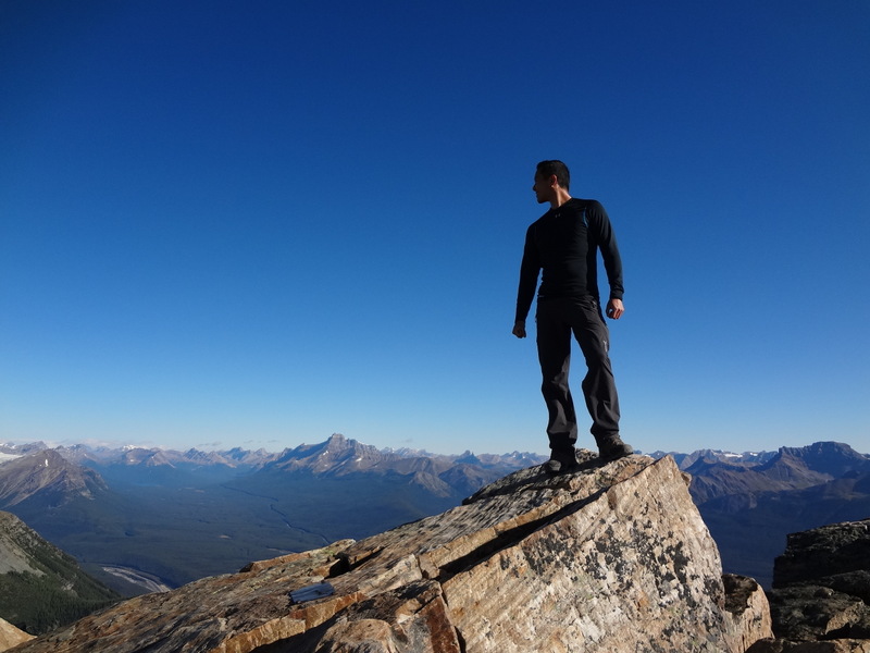
At the top of Mount Fairview. It will do. Most definitely.


Yesterday when I went to bed, I set my alarm for 4:45 am. I was excited knowing that Mount Temple would be crossed off the list by the end of the day! Why did we need to wake up so early? Well, Mount Temple is the highest peak in the Lake Louise area. It’s also the most accessible peak greater than 11,000 ft. At a height of 3543 metres, this ultimate scramble to the summit is a task with an elevation gain of 1690 metres from the trailhead. In general, it takes close to 12 hours to complete. Wow.
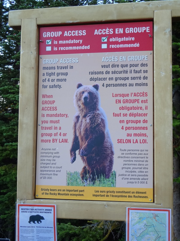
Bear restriction sign. Can’t we just sing show tunes?


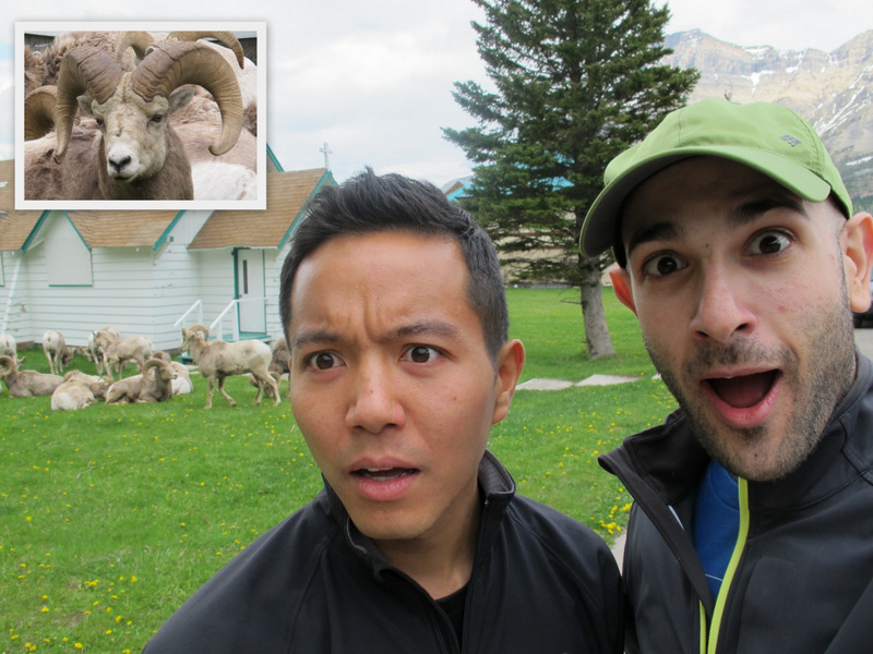
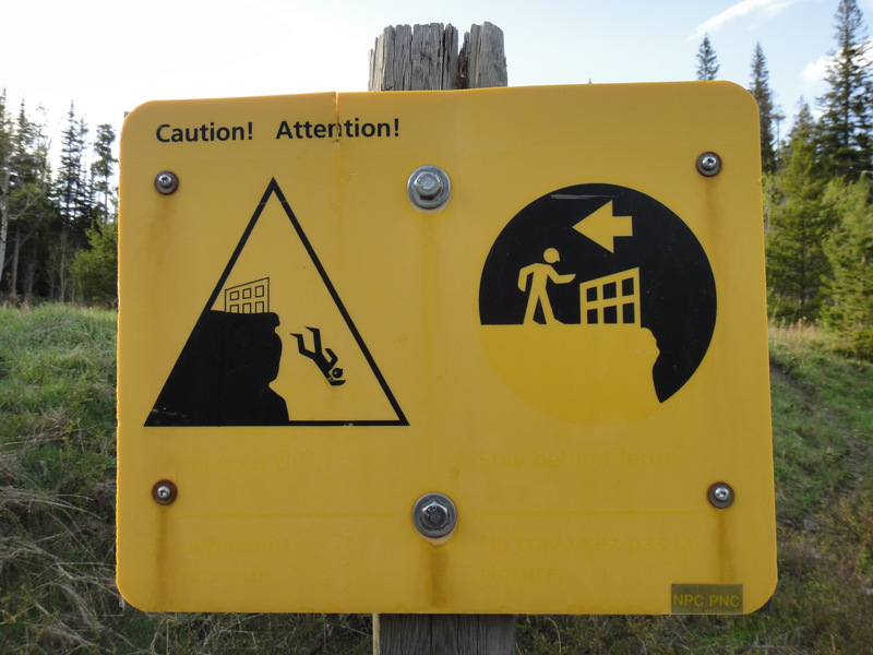
Dan and I got ready quickly and headed down for breakfast. Upon meeting our guide Jason (the same Yamnuska guide from Cascade), we learned that we would not be attempting Mount Temple. Nooooooo!, I thought. The weather was forecasted to be great, and we were so prepared. But alas, in order to hike in the valley where the trailhead for Temple is located, it is required by law to hike in a group of four. Or as the signs read, “Group Access is Mandatory!” Due to some scheduling conflicts, we were only going to be a group of three: Jason, Dan, and myself. Alas, this meant we could not do Temple. *Sigh*. But by now, I’m an expert at combating bears, right? I’ve been preparing for the Big Mountain Challenge for months now. Can’t we should just sing show tunes! I’ll show them…
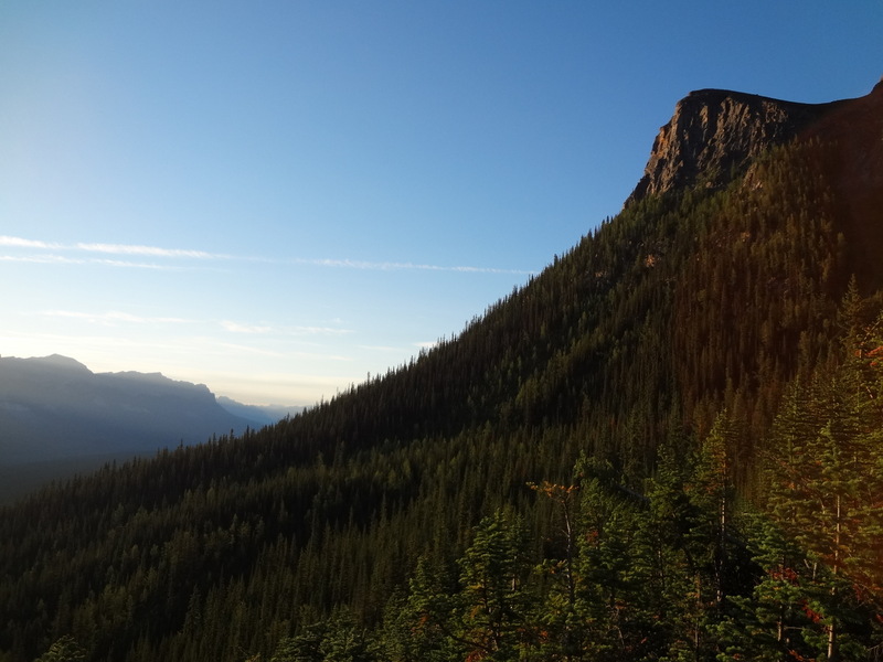
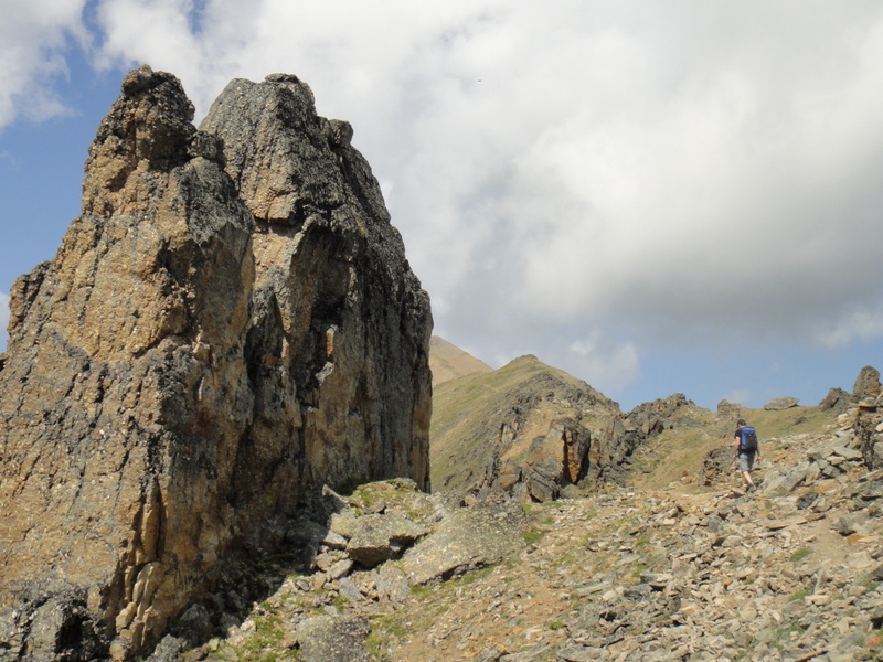
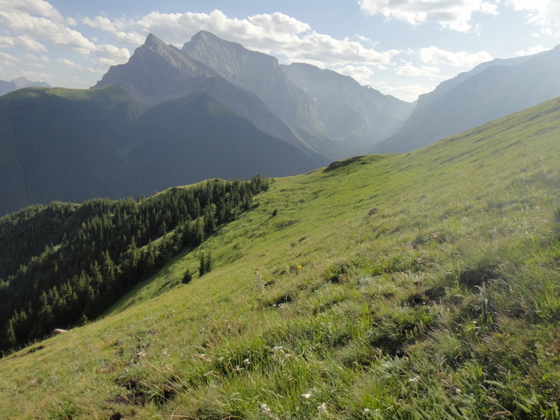
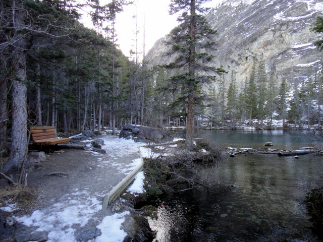
Early morning sun on the forest and mountains
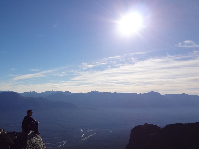
Being thinky


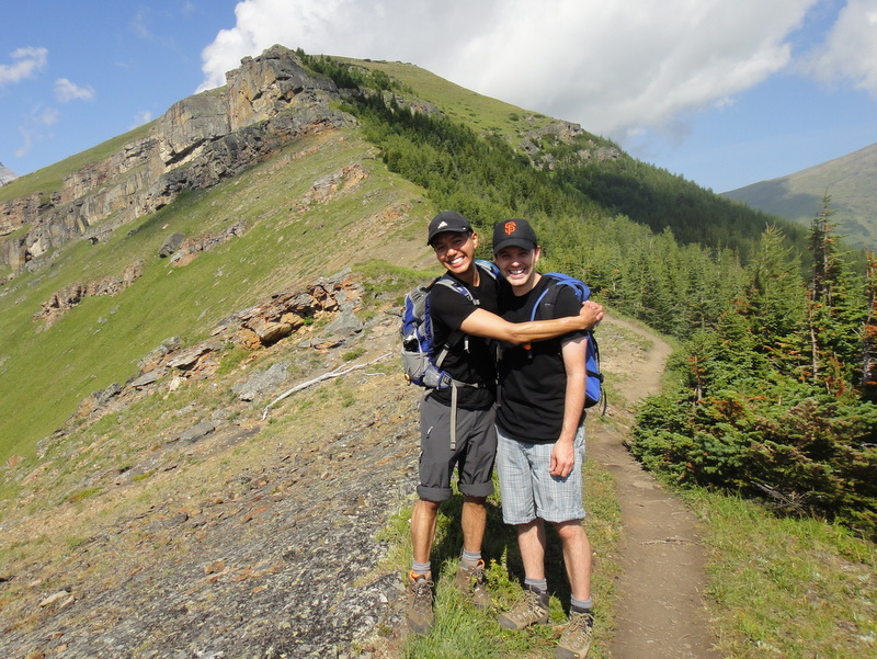
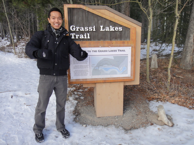
Jason’s backup plan? Instead of Mount Temple, we would ascend Mount Fairview, which towers above Lake Louise, followed by a traverse to Saddleback Mountain. Okay, so it may not have been as epic as Mount Temple, but this new plan would prove to be incredible. You win this round, Mount Temple. I’ll be back to conquer you!
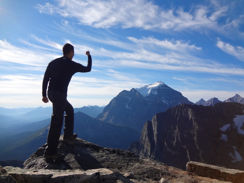
You win THIS round, Temple! *Shakes fist*


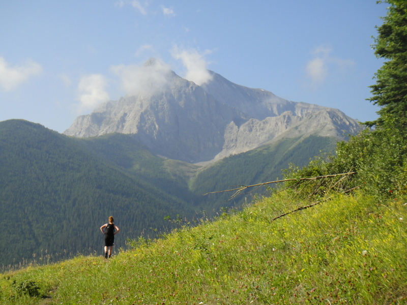
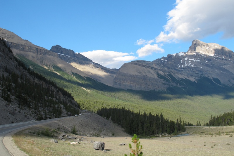
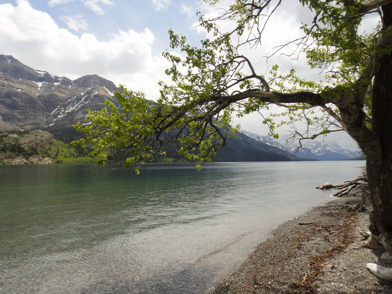
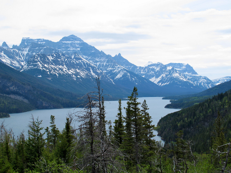
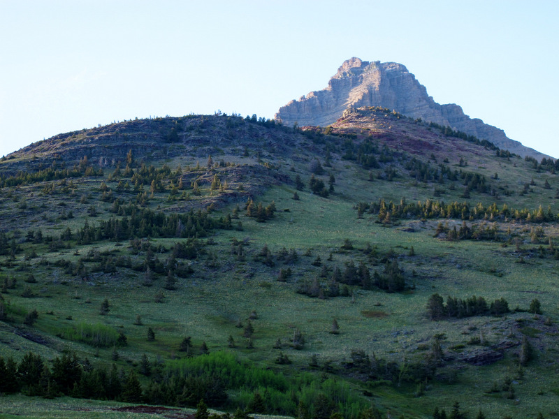
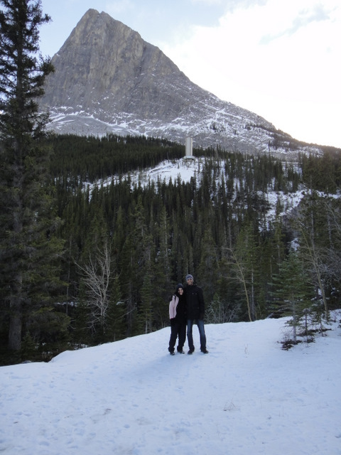
We left the trailhead at 6:45 am as the sun was rising. It was quite serene to be the only hikers on Saddleback Pass. Very quickly we gained elevation and there it was. Mount Temple in the backdrop. Taunting us. Its glacier and snow gleaming at the summit. I began to shake my fist at it. “I’m coming for you!”.
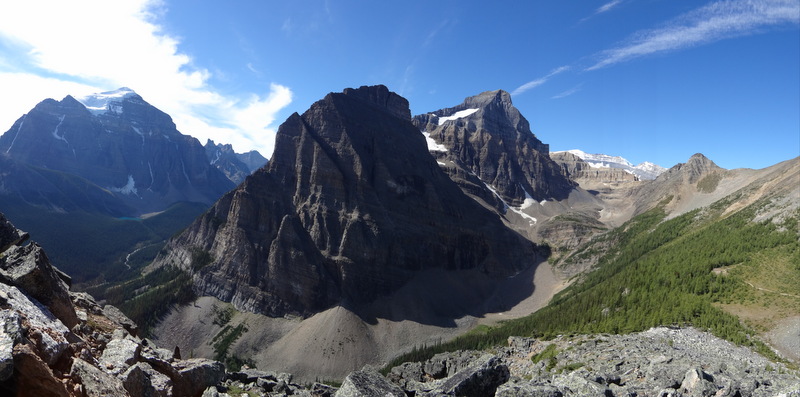
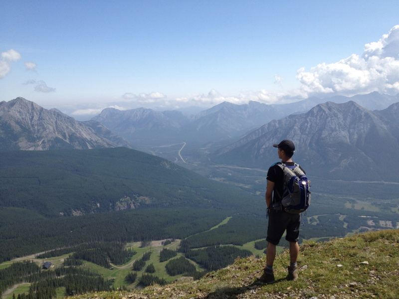
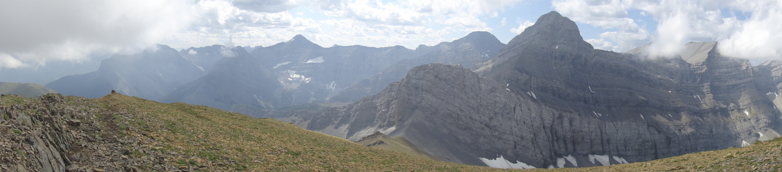
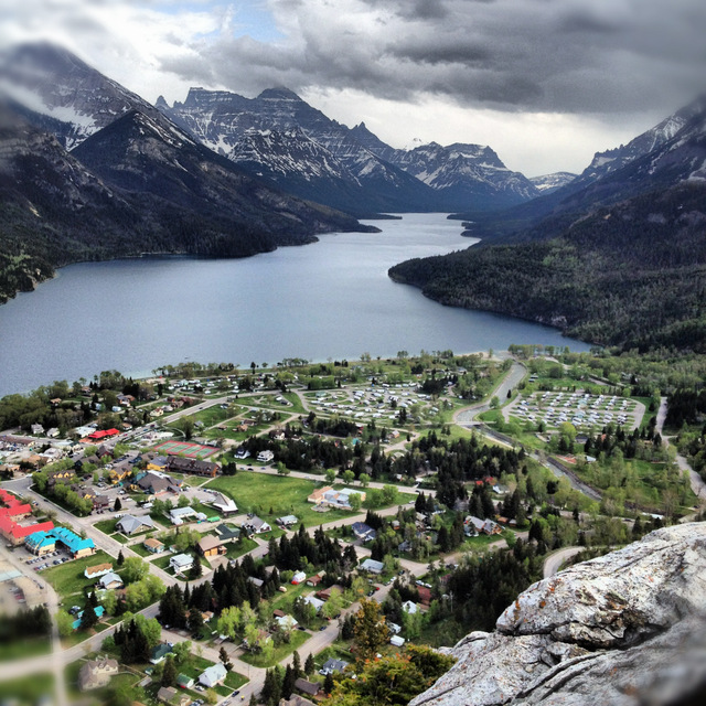
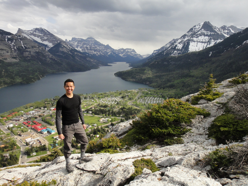
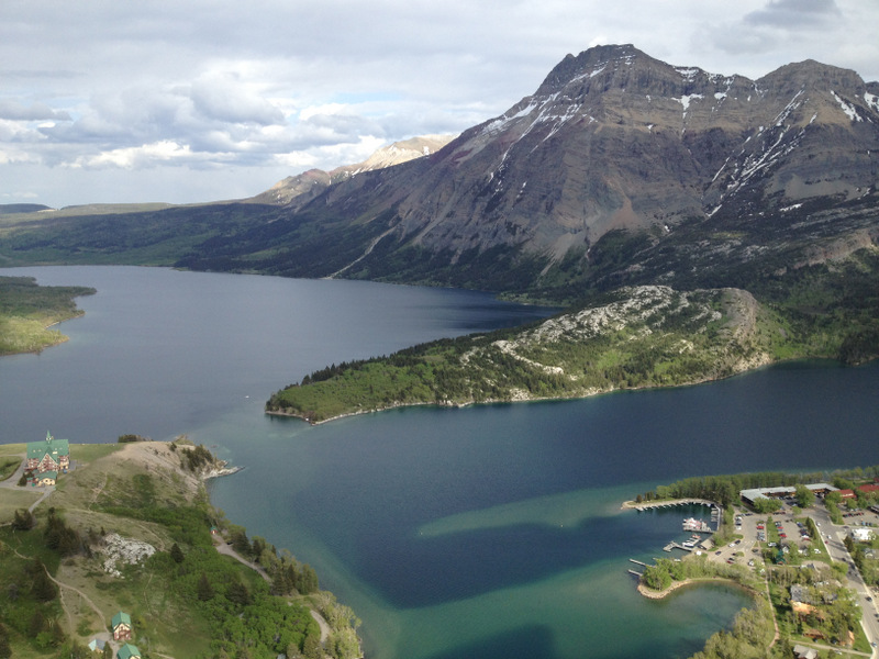
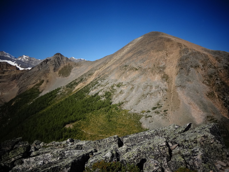
View from the summit of Mount Fairview


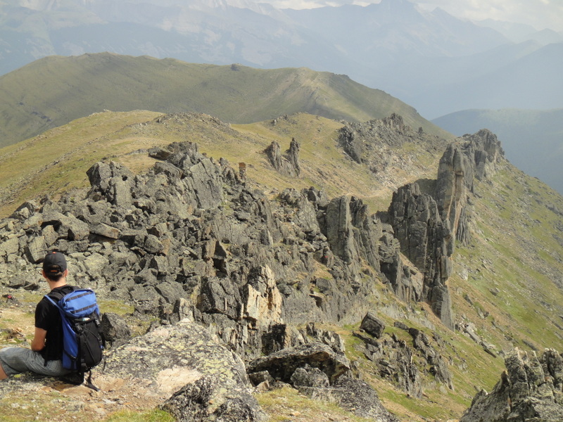
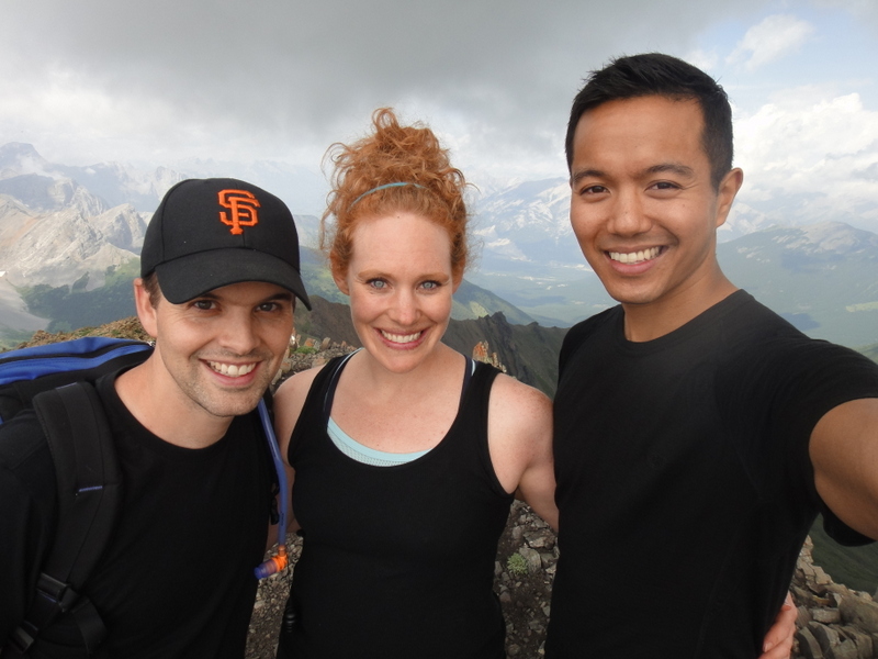
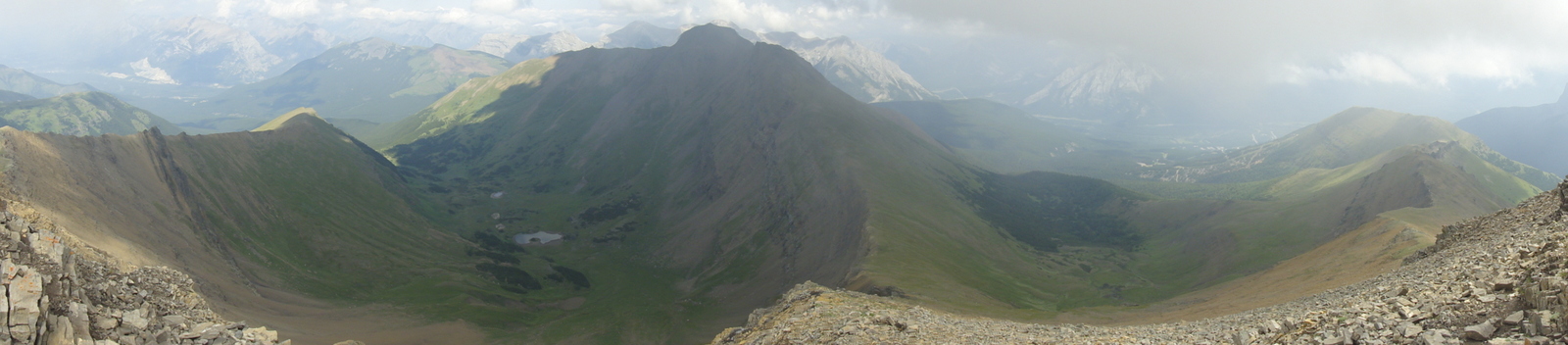
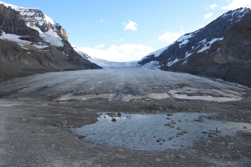
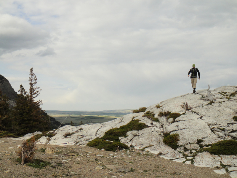
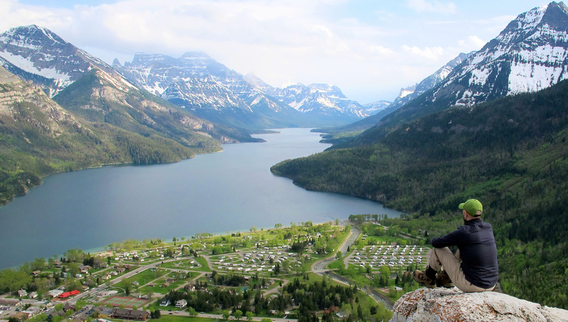
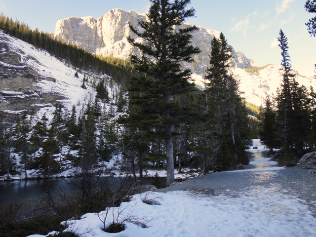
For Mount Fairview, we veered to the right of the Saddleback. The ascent was not as challenging as Cascade, but it made for a great hike. The views around were gorgeous, which is expected when hiking in the Lake Louise and Paradise Valley areas. We reached the summit of Mount Fairview (2744 metres) after about 2.5 hours. Mount Victoria and the Victoria Glacier were in the distance, Mount Temple stood tall with the valley below, and Lake Louise appeared as just a tiny pond. If ever in the Lake Louise area, I highly recommend this relatively short hike!
From the summit of Fairview with the Victory Glacier behind us
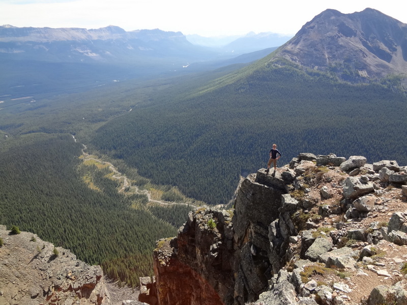
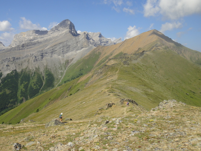
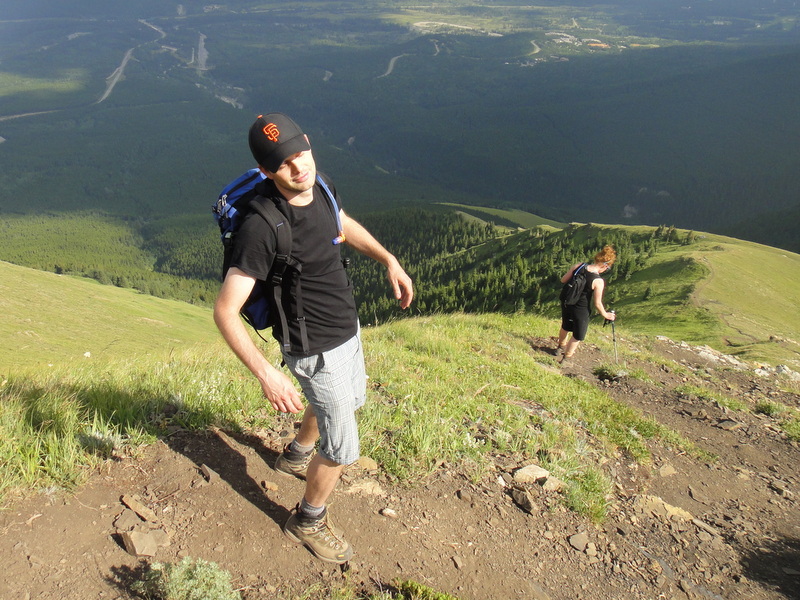
Dan from Saddleback Mountain


It was then time to head back to the Saddleback and up to Saddleback Mountain. The elevation isn’t nearly as high as Fairview, but the rock scramble and ridge walk are quite fun! After many stops for photos, we headed back to the main trail and back to the Lake Louise parking lot for 2:45 pm, a full 8 hours after beginning the hike. It was quite an early return time, but that just meant we had a nice evening to relax :).
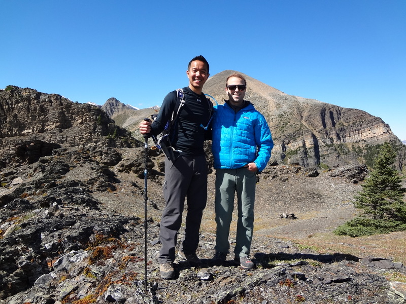
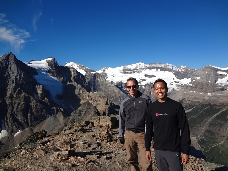
Me and Jason, our Yamnuska guide, and Mount Fairview behind us
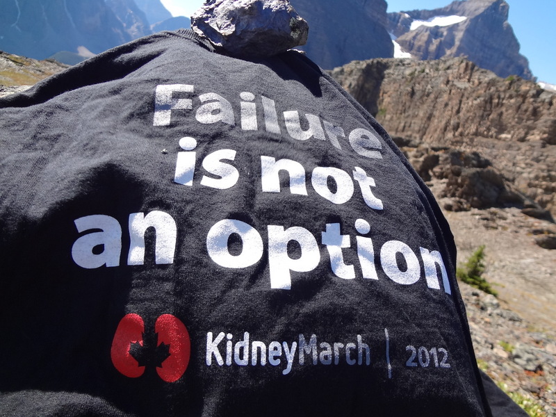
www.kidneymarch.ca
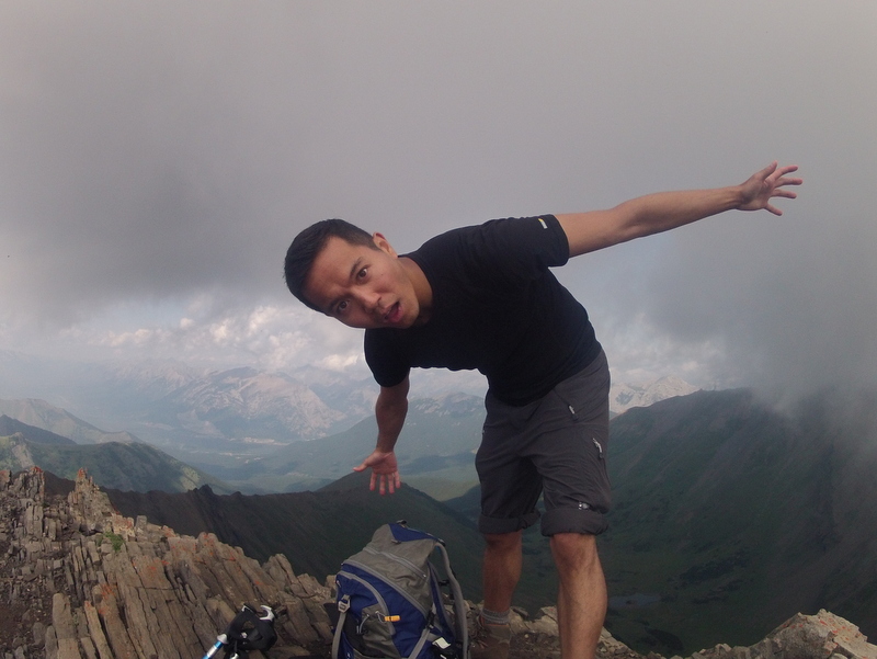
Mount Fairview: We conquered you!


So, throughout the day, Dan and I assumed the role of Banff Lake Louise Tourism correspondents, and filmed a few videos explaining what we were doing throughout the day. We’ve had requests to sing show tunes while hiking, which makes sense since that IS how I prepared for the Big Mountain Challenge, right? By singing show tunes to keep the bears away? Since we were in bear country, we did just that. The first one may not be a show tune from a musical, but it seemed to fit, especially after reading the sign that enforced the Group Access requirement. The second… well that’s just fun! Either way, these are a bit painful to watch, ha!


The Mushroom Kingdom to Mount Allan

View of the Mushroom Kingdom. Its where Bowser lives

A few Sundays ago, I was itching for something epic. It had been a while since I had completed a long day hike, and with three big hikes coming up for the Big Mountain Challenge, I wanted to try and get a few more hikes in there. Paul and Vanessa were on board as well, and so based on recommendations, we chose to summit Mount Allan via Centennial Ridge Trail. The Centennial Pass to Mount Allan Trail is the highest maintained trail in the Canadian Rockies, so it was a definite “must conquer” on the list.

Hiking the Centennial Trail. Gorgeous views the entire way.

We were up super early Sunday morning and headed to Peter Lougheed Provincial Park. The trailhead is located on Centennial Drive, close to the Nakiska Ski Resort. After getting our gear together, we began the hike. It was 9:15 am. We quickly passed a sign informing us that the Centennial Ridge Trail is closed between April 1 and June 21, as the trail is used by Bighorn Sheep and their newborn lambs. Although we were hiking quite later than mid-June, I would have loved to see little lambs on the trail.  Alas, we did not. Woe is me.

BESTIES!!!… but no reciprocation :o|

The trail is quite gorgeous; there are forests, grassy hillsides with many lovely flowers, and great views all around. The earlier part of the hike is also steep, with a stretch that climbs roughly 700 metres in 2 kilometers! I knew it was going to be an epic hike, but I think I underestimated it. Mosquitoes and black flies were on the offensive as well. I even had a black fly attack me through my shirt, which left a big red mark that was itchy for days! I guess that’s what you get when you’re out in nature. I guess. Once we reached the Olympic Summit and Centennial Pass, we checked out the weather stations and admired the views around us. However, there was much more of the hike left!

Flowers on the trail: an Indian paintbrush (Castilleja)
Admiring the weather station
Looking down at the Nakiska Ski Resort from Centennial Ridge

In the distance, there it was: Mushroom Kingdom. Alright, it probably isn’t called that, and some sites refer to it as a rock garden, but the numerous rocks of many shapes and sizes reminded us of a bunch of mushrooms. From a distance, the rocks were tiny, but in fact, they were huge! Hence, the ‘Kingdom’. Plus Bowser (in the form of a squeaking marmot) lives there, so it had to be called Mushroom Kingdom. We wasted no time… onward!

Mushroom Kingdom on the trail (mid/high point in the photo)
I think this was a baby rock ptarmigan/snow chicken. Cute!

Once we arrived at the Mushroom Kingdom, we were awed by the landscape and the formation of the rocks. We stopped here to eat lunch, since there was still quite a ways to go and we had been hiking for hours at that point. The rocks also provided some much needed shade from the intense sun. I don’t know much about geology, but the rocks were incredible. It’s almost like part of the mountain eroded over many many years and left these spires/monoliths. And the rocks themselves were interesting. They looked blackened, perhaps by lichen, and the spires looked as if they were constructed of marmot skulls. Obviously, they weren’t constructed of marmot skulls, and this statement refers to one of the many jokes that arose during the full day hike.

Hiding among the ‘mushrooms’
The highest maintained hiking trail in the Canadian Rockies
Monoliths of the Mushroom Kingdom
Spires filled with marmot skulls. (Note: there were no marmot skulls)

Once we left the rock garden, it was another 40 minutes or so to the summit of Mount Allan, where the views were magnificent. We could see Sparrowhawk in the background, which still ranks as my favourite/most difficult hike in Alberta so far. But Mount Allan did not disappoint at all. Some ominous clouds began to roll in, but not before we could admire the surroundings and snap a few photos.

Toad, Peach and Goomba at the summit
East view (I think) from Mount Allan
West view (I think) from Mount Allan
A storm cloud moving in? What’s up with that?! I don’t know what I’m doing here.

The descent was just as beautiful, but we were exhausted. The downhill went on forever. And ever. And ever. But the late afternoon sun always seems to cast wonderful shadows on the mountains, so it was a different experience hiking to the Mushroom Kingdom, along the ridge, and back down Centennial Trail to the car park.

Another hour to go on the descent?? Let’s just stop here. Close enough.

So we started the trail at 9:15 am, and we had many rest/snack/lunch stops along the way. It was a tiring hike! And the sun was intense- I actually received quite a burn on my calves (oops, forgot the sunscreen there!). We arrived at the summit at 2:15 pm, a full 5 hours after beginning the hike. After taking in the incredible views, we began our descent at 2:30 and arrived at the car for 6:25 pm. Longest. Day. Ever. At roughly 16 km roundtrip, it was a 9 hour and 10 minute hike! Mount Allan stands at about 2840 metres above sea level, and the elevation gain for the hike is 1360 metres. Time-wise, this has officially been the longest hike I’ve done in Alberta thus far. Will Mount Temple in a few weeks be longer?? As tiring as it was, the thought of Chinese food had us rejuved the entire time. “Rejuved” is a word, right?

Beautiful views from the Centennial Ridge Trail.
Mount Allan- We conquered you!

And just for memories, I have embedded this amazing song by Season 4 American Idol winner Carrie Underwood. Because sometimes, when you’re exhausted on the mountain and don’t know where to turn, you just have to trust in a higher power…

Drive the Icefields Parkway. At Least Once.

Driving the Icefields Parkway

A few weekends ago (the August long weekend, to be exact), it was my 31st birthday. With all of the hoopla of the contest win the day after my birthday, I haven’t had a chance to sit down and reflect about that weekend. In a few words, it was very enjoyable, relaxing, and beautiful.
Road trip time
Robbie and I set out from Calgary en route to Jasper. I didn’t actually know what was in store for the weekend, which made it all quite exciting! First stop- kayaking in Banff. I had never gone kayaking before, and it was so much fun! Then it was on to the Icefields Parkway, making photo stops along the way, until reaching Jasper. The next day, we started the morning off with horseback riding, followed by a relaxing afternoon with a short visit to Maligne Canyon. The last day we headed back to Calgary, but not before seeing the glaciers on Mount Edith Cavell, admiring the Athabasca Falls, and taking in the bright turquoise of Peyto Lake. It was a fantastic birthday weekend 🙂
Kayaking in Banff
… so peaceful…
Amazing scenery the entire time on the Icefields Parkway
Approaching the Columbia Icefields Visitors’ Center
Now, I’ve done the Icefields Parkway drive before, and this second time was just as awesome as the first. The mountains are incredible, and the landscape changes from Kananaskis to Banff to the Icefields Parkway and then finally to Jasper. I don’t know a lot about the geology or the formation of the mountains, but something incredible occurred to make them look the way they do. And so, I wanted the take home message of this post to be this: If there is ever an opportunity to drive the Icefields Parkway, do it. It is one of National Geographic’s Ultimate Road Trips, and with very good reason. It really is one of the most beautiful and majestic drives. I acknowledge that I am quite fortunate to live so close to such amazing scenery, but it really never gets old. Every time I drive through the mountains, I’m lost and mesmerized all over again.
Athabasca Glacier
Horseback riding. Yay!
Stopping at Athabasca Falls
You never know what wildlife you’ll see 🙂

A Wonderful Weekend in Waterton

Beautiful Waterton

I had always wanted to go to Waterton Lakes National Park. It is located in southwest Alberta, approximately 3 hours away from Calgary. Rumour had it that the scenery was stunning and quite different than that of Banff or Canmore. So when it came time to figure out what to do for the May long weekend, I thought: Why not Waterton? It turns out that the rumour was true.
On Friday night, Robbie and I packed up our hiking stuff for a weekend of adventuring and left early Saturday morning. The drive was lovely: Prairie lands forever to the left, and the Rockies running parallel to the right. Driving along Crowsnest Highway, the mountains looked epic in the distance while windmills littered the horizon. I love the feeling as you get closer and closer to the mountains. The landscape changes so quickly- the flora, the glacial lakes, and the jagged peaks. I am always in awe.
Upon entering the national park, I noticed a UNESCO World Heritage sign. I had no idea that Waterton was a UNESCO site. I looked it up and in 1932, Waterton Lakes National Park (Alberta, Canada) and Glacier National Park (Montana, USA) were combined to form the Waterton Glacier International Peace Park. In fact, it was the world’s first international peace park. Very cool.
Even though it was a long drive and I was quite tired, there was no time to waste! I decided to walk around the village and take in the sights. Waterton Village is a quaint place, with little shops, hotels and eateries. It wasn’t too busy, but busier than usual because it was the ‘opening’ weekend for the season. The village is right beside Upper Waterton Lake and at the foot of the Rocky Mountains. In short: it’s a very scenic place.
Waterton Village
Waterton Lake
The marina and Emerald Bay

I had heard that Waterton has lots of wildlife. In fact, it’s pretty much bear-central in Alberta. Yes, bears can be dangerous, but more often than not, they’re just as afraid of people as we are afraid of them. So what’s the first thing we saw upon entering the Waterton town site? Just outside of the information centre, a black bear ran across the road as cars slowed to let it cross! Watching a bear run is quite a beautiful sight. They are incredible creatures. Unfortunately the incident happened far too quickly to capture a good photo, but after that, I knew it was going to be a good trip. Fast forward about an hour and a deer walked across a path, right in front of me. And THEN, on our way to the first hike of the weekend, we stopped the car suddenly. There was a herd of bighorn sheep just hanging out on someone’s lawn. Yep, just hangin’ out. NBD. Although I’d like to think they were menacing and ready to attack at any moment, they were quite harmless.

It’s just a deer. NBD. No big deal.
OMG, Bighorn sheep! (The face of the bighorn sheep
has been zoomed in for dramatic effect. Eek!)
Menacing and ready to attack?! Or super cute 🙂 *hug*

I had done some research before the weekend and discovered that hiking to Bear’s Hump was a must-do when visiting Waterton. The incline is pretty steep, but it’s a relatively short hike with 45 minutes to the summit. Regardless, we were decked out in hiking gear, our day-packs loaded with food and water, and we were ready to go. First stop- the information centre. We wanted to be sure that there was nothing to worry about (*cough* bears). It turns out, spring is tick season. The worry wasn’t the bears… it was the ticks! And they didn’t sugar coat it: “Many people get ticks on Bear’s Hump.” Hmm. That didn’t stop us though. Their recommendation was to tuck in our pants into our socks. We complied, and boy did we look like fashionable hikers. But it seemed we were the only ones, since we passed many teenagers, children and infants in T-shirts, shorts and running shoes with ankle socks. Oh well… it’s better to be protected against  ticks than have them burrow into your skin. Gross. In the end, ticks or not, the climb was absolutely worth it. For a short hike, the views are so rewarding. Waterton lies below, boats ferry passengers on the lake, and the majestic mountains stand tall in the background. Incredible.

The summit of Bear’s Hump
View from Bear’s Hump
Prince of Wales Hotel (lower left) from Bear’s Hump
Thinky

We arrived back at the car and checked for ticks for a good 10 minutes. God knows those things could puncture one’s heart, so you can never be too careful. It was still early in the evening, so we decided to visit Red Rock Canyon. The red rocks juxtaposed with the lush greenery as the sun set behind snow-capped mountains made for one of those moments when you realize that there are some truly spectacular places out there. It also made me realize that there’s just too much in this world to see and never enough time or money, *sigh*.

Red Rock Canyon- gorgeous!
Important Instructions:
1) Dive over the fence into the canyon during the day.
2) Teleport back to the fence at night.

After Red Rock Canyon, it was time to find some food. A quick walk along Waterton Lake was followed by gorging at Zum’s restaurant, where apparently they have the World’s Best Fried Chicken!!! Note… I didn’t try the fried chicken, but I’ll make it a point to do so next time. It’s world famous, after all.

Walking along Waterton Lake at sunset. I’m happy to be here!

On Day 2, we opted to hike to Bertha Falls, which is a short hike that starts near the south end of Waterton Village. The roundtrip time was about an hour and 45 minutes with an elevation gain of 150 metres. It may not have been intense, but the climb was enough to give a fantastic vantage point for the mountains surrounding Waterton Lake. After the hike, we geared up to head back to Calgary, but not before making a quick stop to check out the Prince of Wales Hotel, the most recognizable landmark in Waterton.

Hiking to Bertha Falls with breathtaking scenery
Bertha Falls
The Prince of Wales Hotel

Waterton turned out to be a fantastic, relaxing getaway, and we completed the three things we set out to complete: summiting Bear’s Hump, visiting Red Rock Canyon, and hiking to Bertha Falls. I had been wanting to visit Waterton for years, and it did not disappoint. Until next time… and there will definitely be a next time :). One thing I discovered is that there’s a well-known challenge posed to hikers in Waterton. Wait… a challenge?! Anyone who knows me knows that I like to make lists and take on challenges. This one is called the Triple Crown of Waterton. The challenge: To complete three awesome hikes – Crypt Lake, Akamina Ridge, and the Alderson-Carthew Summit – all in one summer. I had to look this up once I got home, and wow… these hikes look incredible. I’ve always wanted to hike Crypt Lake: after taking a ferry from Waterton Village to the Crypt landing site, the hike takes you through beautiful scenery, past waterfalls, through a natural tunnel, and along a cliff ledge with support cables. The other two seem like amazing treks with challenging ridges and fantastic views. After looking at the photos and reading about these hikes, it didn’t take very long before I added the Triple Crown of Waterton challenge to my list. I may even go for the new Fantastic Four challenge through the International Peace Park: 4 days, 4 trails, 2 countries (Crypt Lake and Alderson-Carthew in Alberta, and the Garden Wall and Siyeh Pass in Montana). Where do I sign up? 🙂

Leaving Waterton. Don’t worry- I’ll be back… 🙂

A Winter Hike at Grassi Lakes

GrassiLakes2011-1
Grassi Lakes

Wow, it’s been a while since I’ve posted a hiking-related entry. That’s probably because evil winter came, and along with it, snow and cold weather. I don’t really like cold weather :(. I often want to punch winter in the face. But I don’t mind winter activities even though I don’t partake in them very much.

Well, today, friends Robin and Tushna and I decided we would head out to Canmore for a winter hike. You know, ’cause nature is pretty cool and stuff. The temperature was remarkably mild for this time of year and the sun was shining, so it was the perfect day for a trail. After stopping off at an information centre in Canmore, we decided on the Grassi Lakes hike, which I had wanted to do for quite some time. Grassi Lakes wasn’t so grassy, but the snow cover made everything look beautiful. I wouldn’t call the trail strenuous by any means, and it took maybe 1.5 hours, but it was a really nice little hike after being on a hiatus for a couple of months :). And the company was great as always- lots of chatting and laughing and jokes. The perfect way to spend a Saturday afternoon!

GrassiLakes2011-2

GrassiLakes2011-3

GrassiLakes2011-4

GrassiLakes2011-5