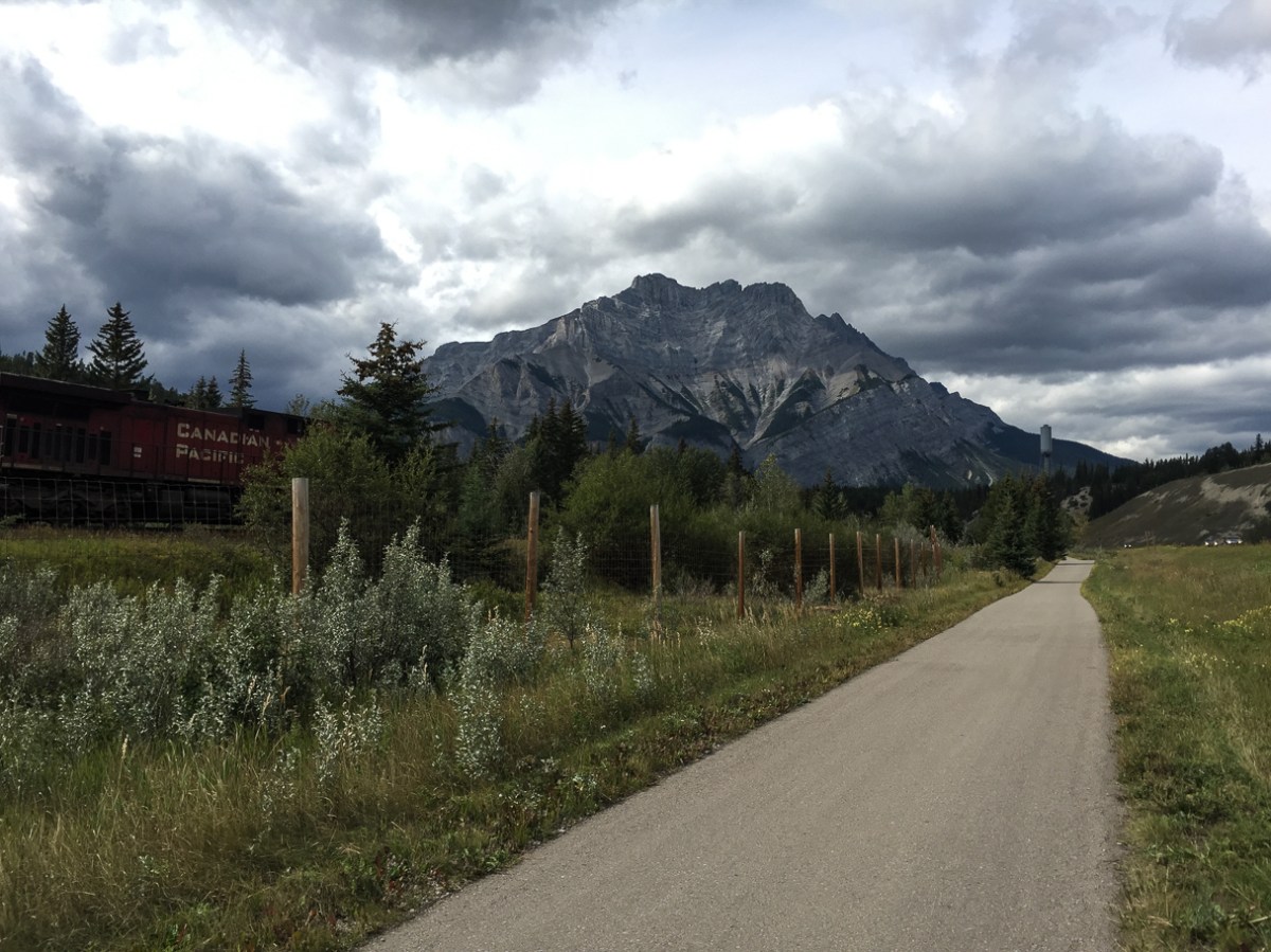
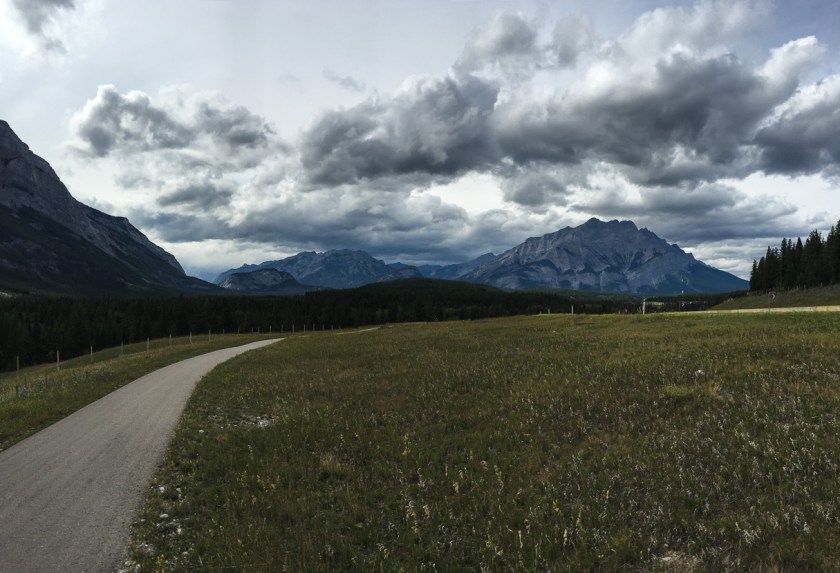
My bum… is numb.
That was my second thought once Robbie and I completed the 21.8 km Legacy Trail from Canmore to Banff. I haven’t been on my bike enough lately to comfortably endure that distance.
My first thought was: We did it!
My bum… is numb.
That was my second thought once Robbie and I completed the 21.8 km Legacy Trail from Canmore to Banff. I haven’t been on my bike enough lately to comfortably endure that distance.
My first thought was: We did it!
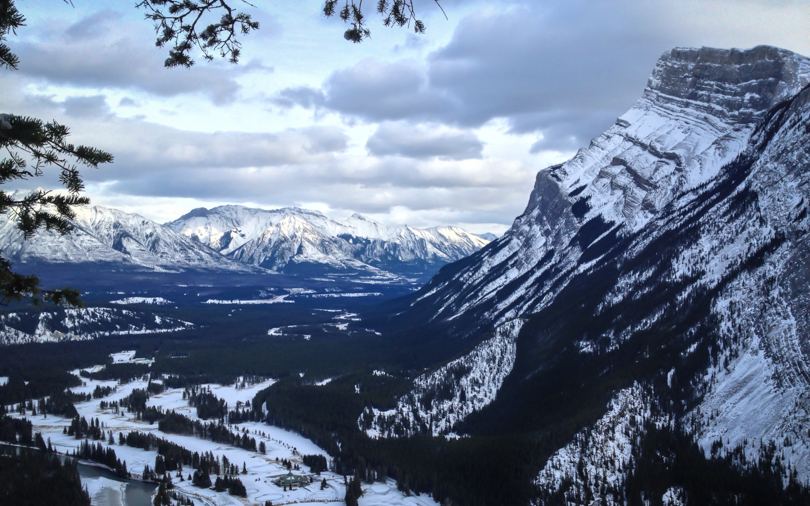
 Last weekend, the snow came to Calgary. It was one of those weekends where I stayed around the city. I knew that this weekend… the long weekend… a visit to the mountains was necessary. I get really antsy when I haven’t visited the mountains in quite some time, and for me, ‘some time’ is more than a week! So Robbie, Tushna, Shari and I headed out to Banff today ready to climb something. It was cold but the sun was shining, and the weather was ideal for a winter outing. We didn’t want anything too strenuous, so we opted for a quick hike up Tunnel Mountain. Tunnel Mountain will always have great memories for me (Os!), and for not a lot of effort, there are beautiful views of Mount Rundle, the Bow Valley, and the town of Banff. The path was snowy and a bit icy at times, but the spikes helped with the grip. It got me thinking- if there are ever days where I need to do a winter hike up a mountain, Tunnel Mountain is a good ‘go-to’. I’m hoping that this marks a bit of a change. October and November are always very difficult months, from motivation to mood. But getting out to the mountains felt so great and definitely made me more excited about the winter activities to come.
Stats
Start: 2:25 pm
End: 4:20 pm
Distance: 4.3 km roundtrip
Elevation Gain: 300 m

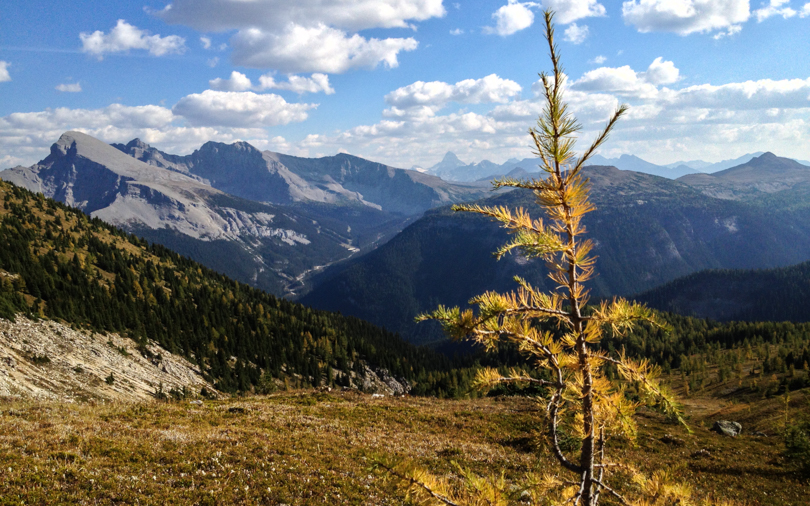
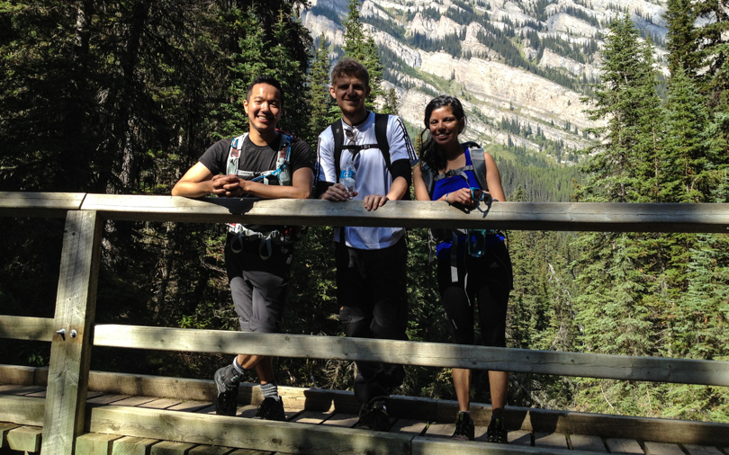
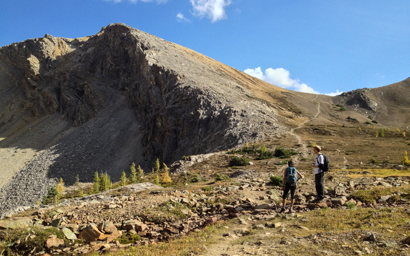
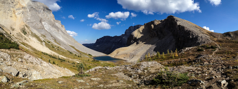
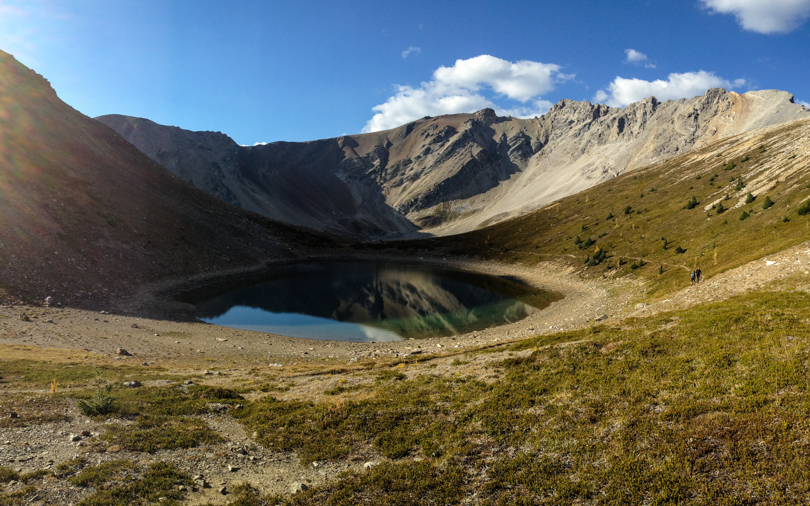
This hiking season has been about the “Classics“. In previous years, I was determined to “bag peaks”, or hit as many summits via scrambling as I could. But this year was a bit more tame. I opted for a more hiking approach: to spend lots of time in the outdoors, hike among different scenery and locations, and try to enjoy some of the hikes that Banff and Lake Louise have to offer. Earlier in the season, I’ve ventured to the Lake Agnes and Plain of Six Tea houses, hiked around Tunnel Mountain to the hoodoos in Banff, and got completely lost on the Cory Pass and Mount Edith Circuit. This past weekend, Shari, Bjorn and I would hike to Bourgeau Lake and Harvey Pass, which is another classic hike in Banff National Park.
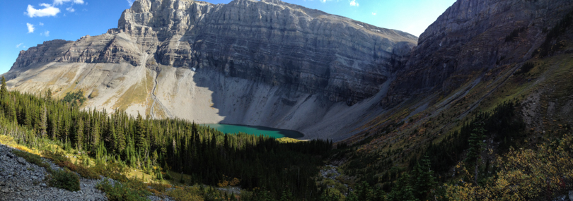
About 8 km west of Banff is the Bourgeau turn off. We parked, geared up, and began the hike. It was a late start, but we were in no rush. The first few kilometres through the forests on a well-travelled path seemed like it went on forever, but it was worth the trek to Bourgeau Lake. The backdrop of Mount Bourgeau was stunning! We plugged onward, ascending the rocky path toward Harvey Lake and the pass.
The section between Bourgeau Lake and Harvey Pass was gorgeous! Little waterfalls; green trees with golden grass and shimmering tarns lined the path toward the pass. Once we arrived, the view was beautiful. In the distance, Mount Assiniboine rose high into the sky. To our left, Mount Bourgeau taunted us, since it was too late in the afternoon to begin the summit ascent. We could see Sunshine Road and the gondola to the top of the mountain, which was crazy to see in the summer. I wonder what hikes are in that area! It was a long trip back to the car but the day trek was well worth it. The weather was beautiful and the company was great- ingredients for an awesome hiking day.
The only not so great thing? The black liquorice candies that Bjorn brought. Apparently they love them in Denmark, especially the salty kind. Thanks for sharing, Bjorn, but my palette was not ready for such an acquired taste!
Stats:

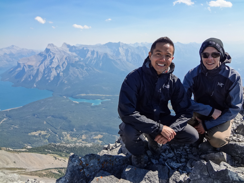
Exactly one year ago, I was in the midst of an incredible experience. Dan and I were hiking up Cascade Mountain with a Yamnuska guide, a Parks Canada guide, and Jeff from The Real Banff. I had won the Big Mountain Challenge that month, which resulted in a $26000+ donation to The Kidney Foundation of Canada. Of course, hiking mountains was also part of the win… and hiking mountains is what we did!
Fast forward a year later, and Dan (this time accompanied by his brother) is about to board a plane en route to Calgary for what we have called the Big Mountain Challenge-versary! Dan and I don’t see each other very often since we live in different cities, but when we do, there’s usually some sort of adventuring to be had. And since I have had a lack of scrambles this year, scrambling will be part of the adventure! All I know is that I’m pretty stoked about a weekend filled with hiking, laughs, and shenanigans. I guess spending quality time and catching up is okay too eye roll.

This weekend was my first double-hiking weekend of the summer. I’m quite tired and exhausted as I write this, but it felt good to test out my ankles and head out to the mountains. I figured it would be good preparation for my backpacking trip to Glacier National Park in a few weeks!
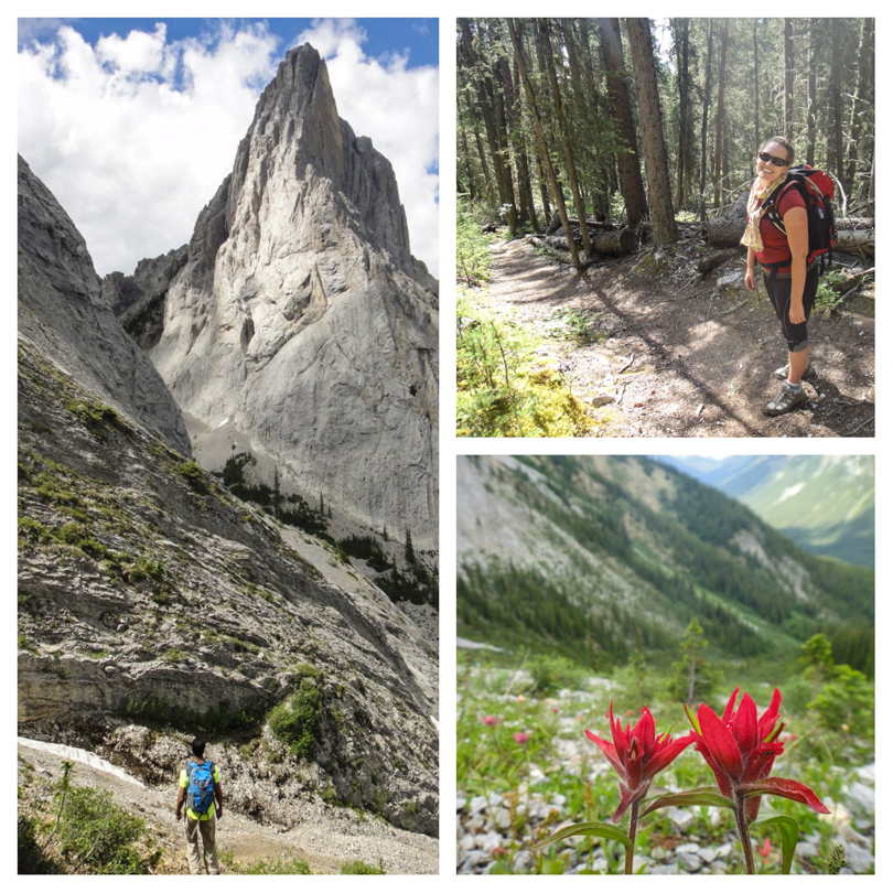
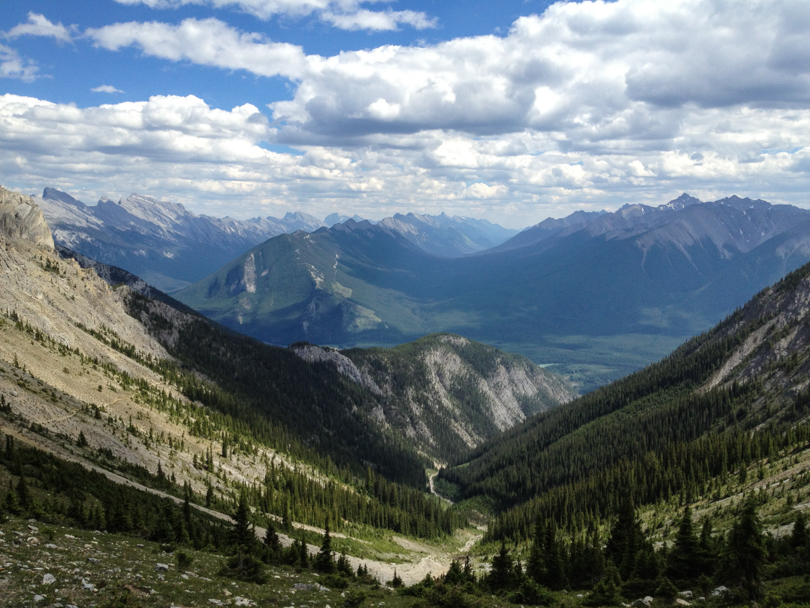
On Saturday, I recruited Robin and Jess and we were off to Banff to hike the Cory and Edith Pass trails (aka the Cory Pass Loop). It’s a hike that starts just a few kilometres west of Banff at the Fireside Picnic Area and is one of the popular ‘classic’ hikes to do in Banff National Park. The flooding in Kananaskis this year has prompted me to look into hikes in the Banff and Lake Louise areas. The Cory Pass Loop is noted as one of the most beautiful and scenic of Banff’s trails, but also one of the more difficult ones.

At the junction, we decided to proceed along Edith Pass trail. Apparently Cory Pass trail is the recommended way, but since I failed to do my research, heading to Edith Pass first seemed like the best choice. At this point in the hike we were dying already. Not because of any incline or the heat… nope, it was due to mosquitoes! I’ve never been swarmed like this before during a hike in the rockies. And there seemed to be something about the scent that I gave off, because they were more attracted to me than both Robin or Jess (although they got attacked a ton too!). Thank goodness for bug spray or I would have been eaten alive, more than I already was! (As I write this, I can’t stop itching my arms and legs… ahhhh!). The hike itself was quite nice as we made our way through forests on the east side of Mount Edith while making a steady ascent.
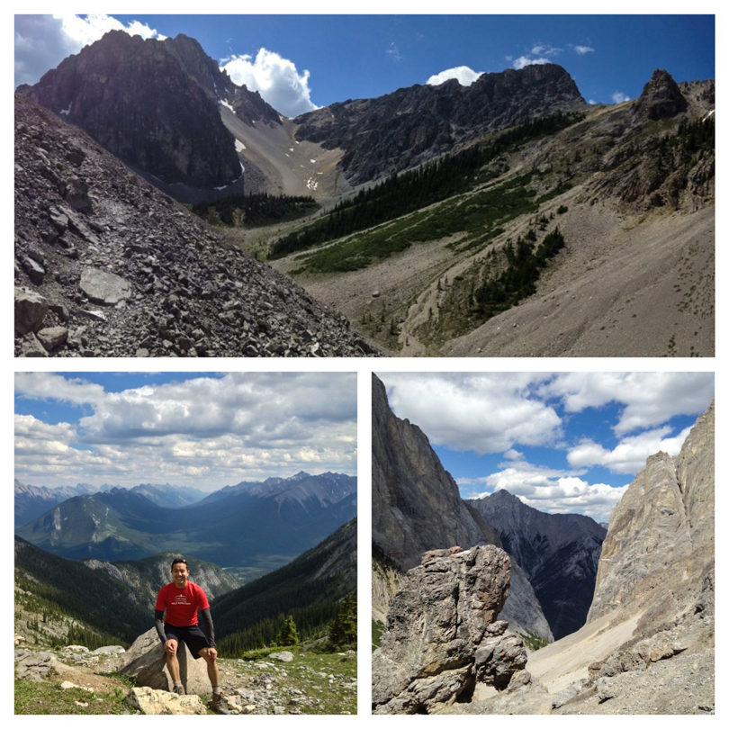

As we ascended the rocks to the highest point of Edith Pass, the gargoyles came into view. The formations don’t quite look like gargoyles, but they’re pretty awesome rock formations. It was also cool to be in the shadow of Mount Louis- that’s quite the rock face. Proceeding onward around the north side of Mount Edith, Mount Cory came into view and so did an amazing view of the southern mountains from Cory Pass. It was pretty breathtaking. Of course, we stopped for a few photos. Proud and jovial about our accomplishment, it was time to head back to the trailhead via the Cory Pass trail.


All was well until we hit a seemingly dead end! Later I would google that although there’s some route finding to do, there’s nothing too crazy about the hike. But at that moment, we didn’t know where to go and decided we would head left onto an unmarked former trail and make a ridiculous descent down the side of Mount Edith. All seemed fine and good… sort of… until we started hitting fallen trees on the trail. Then overgrown foliage. Then the trail was covered in moss. Then there was no trail. I suddenly felt like something was wrong! For an official trail in Banff National Park, our path certainly did not look maintained. We made the decision to continue on, having descended so far after about 30 minutes. I began to panic and suddenly became worried. We were so far off course, and although we knew the general direction to the highway, we were facing old fallen trees and lots of obstacles. I played out scenarios in my mind- being blocked by a river; having a medical emergency due to a dangerous branch; or worse, running into a bear. Our bear calls were booming every few seconds. And since Jess and I were wearing shorts, our legs were destroyed by mosquitoes and numerous scratches. We climbed above and under so many branches. I do feel bad about losing my cool, but focus just set in, and all I wanted to do was get out of the forest. Suddenly I yelled, “What’s that!!?”. Robin and Jess were startled. Their heart rates accelerated. A bear? No… it was the trail! I have never been so happy to see a trail before (well, maybe I was just as happy when Robbie and I got lost on Tent Ridge last year). Suddenly our “Whooooops” to scare the bears away became “Whooohoooos” to describe our elation. And this trail was maintained. In fact, it was the same trail that we started on. We had managed to make a descent down a random side of Mount Edith back to the Edith Pass trail rather than continue on the Cory Pass trail back to the official junction. Argh! To top it all off, I managed to twist my right ankle. Not the bad left ankle… the good right ankle. Now both ankles hurt! Weeeee!
So in the end, this goes down as not the greatest second half of the hike, but without a doubt the views on Cory Pass are spectacular. Next time I’ll go the recommended way: Cory Pass first, followed by a gradual descent on Edith Pass trail. Although this way will have an 885 metre ascent in just 4.5 km, it sure would beat our random descent. Yep, that’s the way to do it. All hiccups aside, the Cory Pass Loop made for another great hike with great weather and great company :).

Stats:
Start: 11:20 am
End: 6:30 pm (long day!)
Elevation gain:
Distance: 13 km