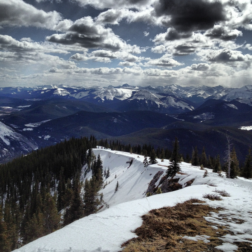
View from Prairie Mountain. Always a wonderful sight 🙂
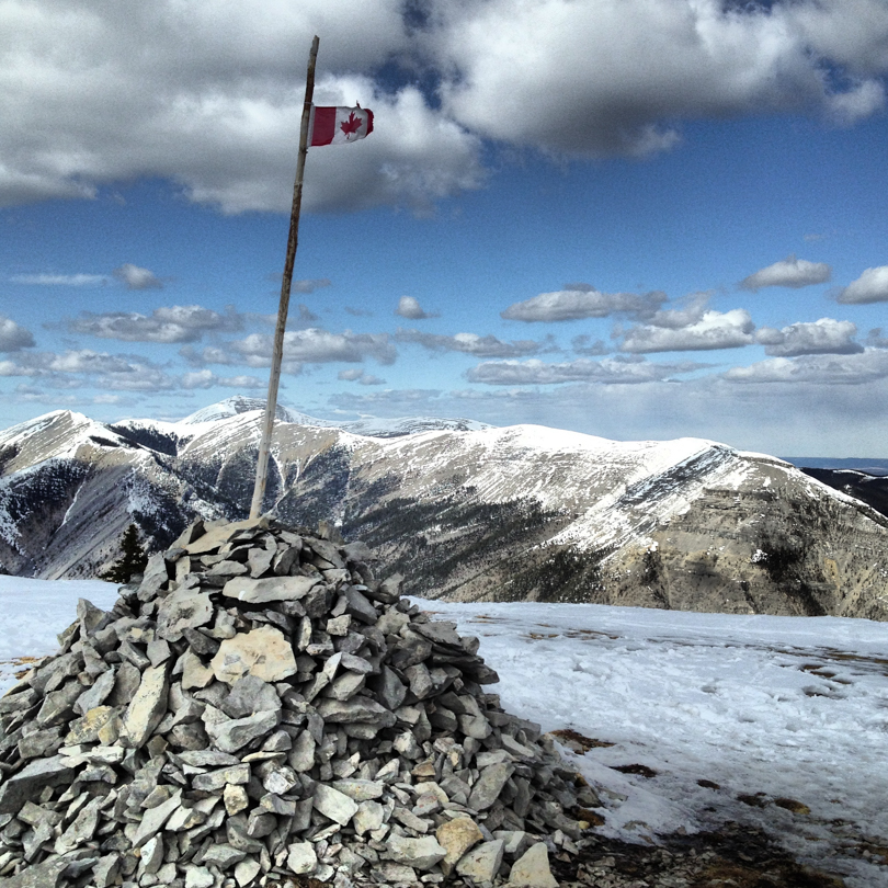
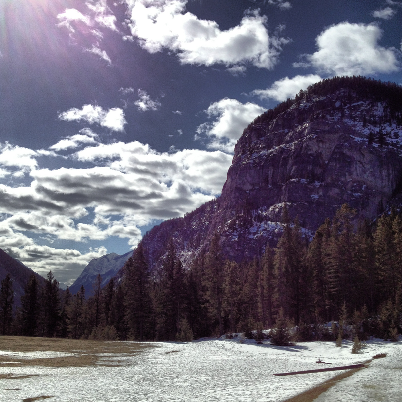
It may only be the end of March, but I have now declared the start of hiking season! The weather has been so gorgeous lately that it’s hard not to drop everything and get out to the mountains. After Thursday’s attempt at Tunnel Mountain with Sony (only to encounter sheets of ice on the trail), I headed out to Prairie Mountain on Friday, which always makes a good shoulder season hike. Thankfully, all the squats from Shaun T’s Insanity have truly been doing wonders, and my legs did well to get to me to the summit. My XTR ice spikes also helped with all the snow on the mountain. Prairie continues to be a grind each and every time. I started the trail around 1:40 pm, reached the summit at 3:10 pm, and then was back at the car for 4:10 pm. This will be my initial metric to compare future times, as this will not be the last time I do Prairie Mountain this season!
Thank goodness for the ice spikes!Reaching the top of Prairie MountainTunnel Mountain- We’ll get you next time! *shakes fist!*
It’s been almost a month since my last blog post, yikes! It’s easy to say that life and stresses got in the way (which would be true), but that shouldn’t be an excuse. The first quarter of the year has been interesting, but I’m ready to put that behind me and start anew. What better way to get back into the groove than with a hike!
Today was a gorgeous day, so when my friend Lauren asked if I wanted to join her, her husband and their dog/small horse on a short hike, I couldn’t resist. Destination: Fullerton Loop in the Bragg Creek area. I’ve never hiked it before so I was very much looking forward to it. And since I haven’t done a lot of winter hiking, I was eager to get out and hike!
Fullerton Loop is not overly strenuous: at an elevation gain of 364 metres and a distance of 6.5 km, it’s not too bad. The interesting thing about the hike was the crazy amount of ice beneath the snow, which made for a slippery couple of hours. And since I hadn’t hiked in quite some time, my body was not used to the elevation gain and incline. What should have been an easy hike ended up giving me quite the workout! It sure felt good, and I can’t wait until the summer hiking season begins. There are many epic mountains on my list and lots to be conquered, but hiking Fullerton Loop reminded me that the hikes don’t always need to be extravagant. Today’s hike was a short one close to the city, but offered a great escape to the mountains. And when there’s awesome company, it’s an outing that’s absolutely worth the time.
So this is the time in Rockies when the larch trees are at their most beautiful, turning shades of yellow in the late fall. During this time, many Calgarians will flock to the Larch Valley near Moraine Lake in Lake Louise. I had hiked there in 2010 and it’s spectacular. However, I had heard that two weekends ago, there was a crazy car line up to the Moraine Lake parking lot, where it was a one-in-one-out situation. Rather than attempt to fight the crowds, there were many suitable alternatives for a weekend hike.
One side of the ridge from a clearingTent Ridge Horseshoe
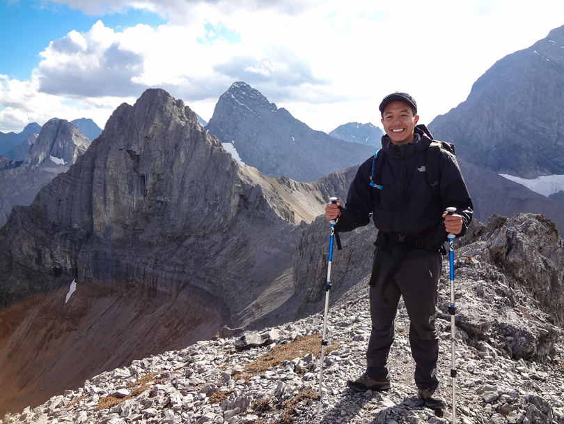
On Saturday, Robbie and I ventured out to Kananaskis. We decided we would find a hike that both of us had not completed. After hearing great things about Tent Ridge, we thought, why not do that one? From the Kananaskis Lakes turn off on Highway 40, we headed about 29 km north on the Smith Dorrien – Spray Trail (#742 South) to the Mount Engadine Lodge. The parking area was close to there.
Taking refuge beside a cliff for a quick lunch stopTraversing the ridge. I love ridge walks!
After searching for and finding the trailhead, it was a gradual ascent and then a steep slog to the clearing where we would begin climbing the mountain. The views were incredible every step of the way. There’s definitely no need to go to the Larch Valley to see larches! They were yellow and beautiful (though it’s slightly late in the season, so many of the leaves have fallen); there were mountain peaks all around us; and the Spray Lake Reservoir shimmered in the distance. The ridge is shaped like a horseshoe and has three summits, so there was a lot of variety throughout the day, including short sections of scrambling. The exposure wasn’t too bad at all, and it was all worth it to hike in the shadow of such peaks like Mount Smuts (2938 m) and The Fist (2630 m). Hopefully one day I’ll conquer those too…
Looking over the edge. Yikes!I’m happy to be here!
The descent was an interesting one. We somehow veered off the trail and ended up bushwhacking through dense forest to find it again. We knew we were going in the right direction, but with no clear path, we were nervous! The sun was beginning to set, so it was evening time in bear country… not a comforting thought. I think I may have even seen a bear dig at one point, which freaked me out even more. This hike, more than any other, had constant bear whoops and yells to keep the bears away. We even began running at times to speed things up. I acknowledge that we probably scared ourselves more than anything, but it definitely felt like a situation where show tunes wouldn’t have even helped :S. In the end, we made it to the car alive and well. NBD. What a fantastic day hike!
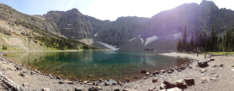
I have conquered this mountain!View of the Spray Lake Reservoir from the summit
We were able to ascend the mountain, traverse the ridge, and get back to the car in 5 hours (12:40 pm – 5:40 pm; 11.5 km loop). According to one website I found, the highest point of the ridge is at about 2545 m, and the elevation gain is approximately 830 m (I think that’s cumulative). I don’t hike too many ridges, but I need to start adding more to the list. Hiking up one way and back down a different route is very cool! I should also add more Smith Dorrien peaks to the list. So many peaks. So little time…
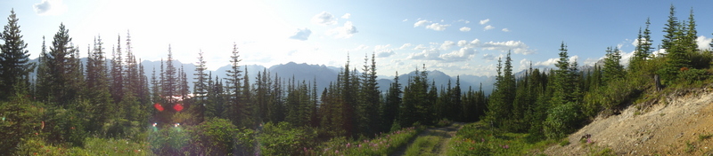
Panoramic of the Tent Ridge HorseshoeView from the summit. Amazing!
Sigh, it’s been so long since I wrote my last post. Truth be told, once the Big Mountain Challenge was over, I was on a bit of a self-imposed hiatus from anything social media. I’ve never done so much blogging, facebooking and tweeting in my life! But now it’s time to get back into the swing of things. I figured I’d start slow, so this is going to be a pretty short post.
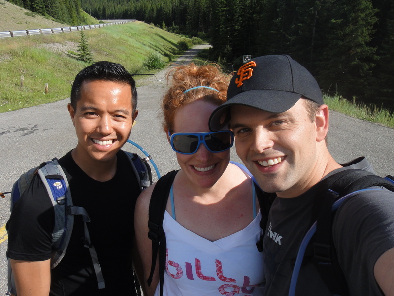
Last weekend, I visited Waterton Lakes National Park with a few friends. I was there earlier this year as the bears were awaking and the ticks were in full force. This time, the trip had a specific purpose: To hike to Crypt Lake, which was on my list.
Ever since I heard about the Crypt Lake hike, I was sold. And the hike certainly did not disappoint! After boarding a ferry from the harbour in Waterton, we headed to Crypt Landing. We had about 7 hours to complete the entire hike, which was definitely enough time. There were quite a few people on the ferry, all eager and excited. The weather was cooperating, and we were pumped!
The hike was a gradual climb among one of the most beautiful areas in Canada. Actually, it was voted “Canada’s Best Hike” in 1981! Along the way, we journeyed through forests, passed waterfalls, crawled through a natural tunnel created by erosion, traversed along a rock face while holding onto a steel cable, and was then rewarded with the amazingly bluish waters of Crypt Lake. The scenery was gorgeous the entire time, and the views of the colourful valley was incredible. We even caught sight of a mountain goat on the side of the mountain. Very cool!
All in all, I would recommend Crypt Lake for anyone wanting an amazing day hike that’s challenging enough to feel like work has been done, but do-able enough to ensure a sense of accomplishment! The total time for our hike, with stops for breaks and lunch, was 6 hours and 40 minutes. It took 3 hours from Crypt Landing to the lake. There’s a 700 metre elevation gain and a roundtrip distance of 17.2 km. Not too bad for a day’s work, and definitely worth it. And just like that… Crypt Lake, you’re off the list!
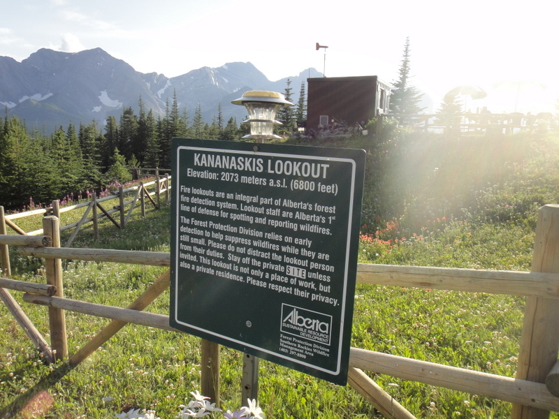
Okay, it’s not really a driveway. And in fact, it’s the hike to the Kananaskis Fire Lookout in Peter Lougheed Provincial Park. But since there is a couple living up there, and they own a car, the trail is pretty much a long dirt driveway. And why is it called a Fire Lookout? So that the couple can watch the area for forest fires and alert the appropriate authorities. Sounds important to me!
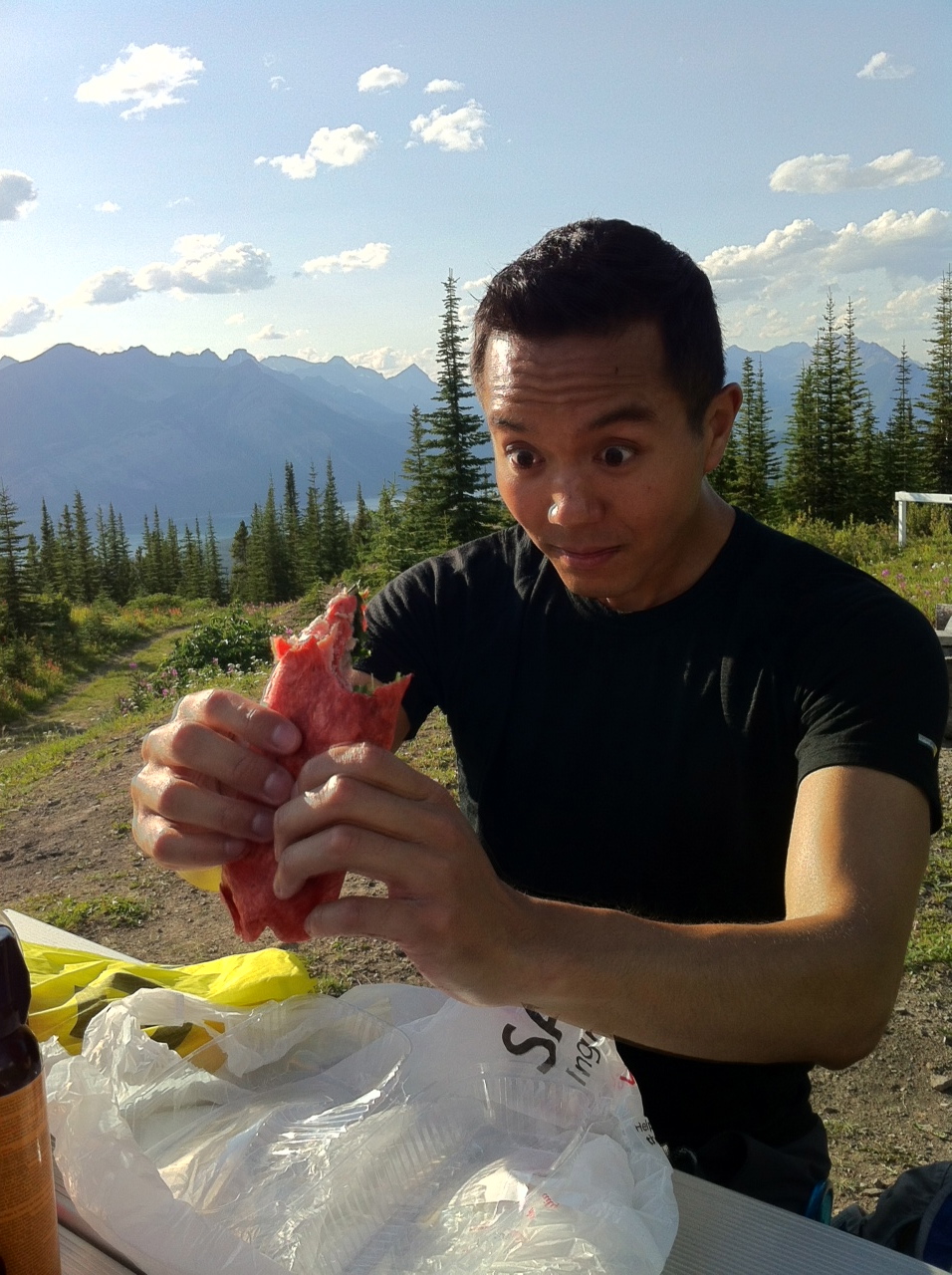
Pre-hike photo
Friends Paul, Vanessa and I thought it’d be great to head to the mountains right after work. So after a productive day in the office, I gathered my things and we were off. We chose the Kananaskis Fire Lookout based on a recommendation from the info center, even though the girl told us that there were 20 known grizzly bears in the surrounding area. NBD, no big deal. (Truth be told, most definitely not NBD. But we made sure to make lots of noise while hiking). It was a short hike (5:25 pm to 8:15 pm) with an elevation gain of 296 metres, but the views of the Kananaskis valley and lakes were very nice.
At the lookout
Photo from the view point
At the top, we stopped to sign the guest book and sat at a picnic table for dinner. And then it dawned on me: How amazing is it to live in a city like Calgary, where I can work at my desk throughout a Friday, and then be sitting at the top of a mountain in the evening for dinner overlooking the Kananaskis valley… all in the same day?! It’s definitely not something I take for granted :).


 It’s been almost a month since my last blog post, yikes! It’s easy to say that life and stresses got in the way (which would be true), but that shouldn’t be an excuse. The first quarter of the year has been interesting, but I’m ready to put that behind me and start anew. What better way to get back into the groove than with a hike!