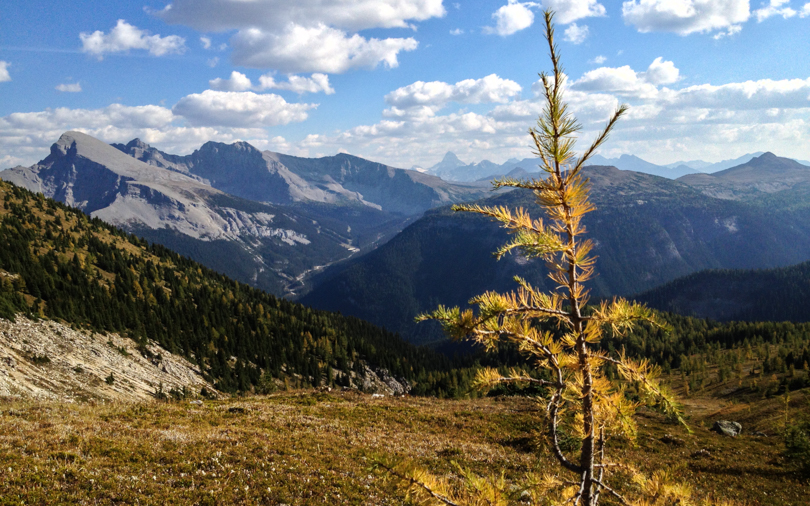
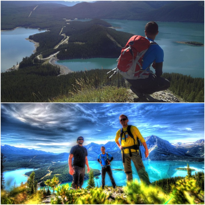
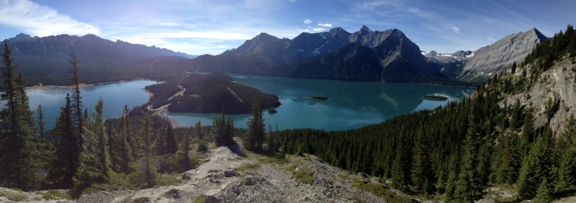
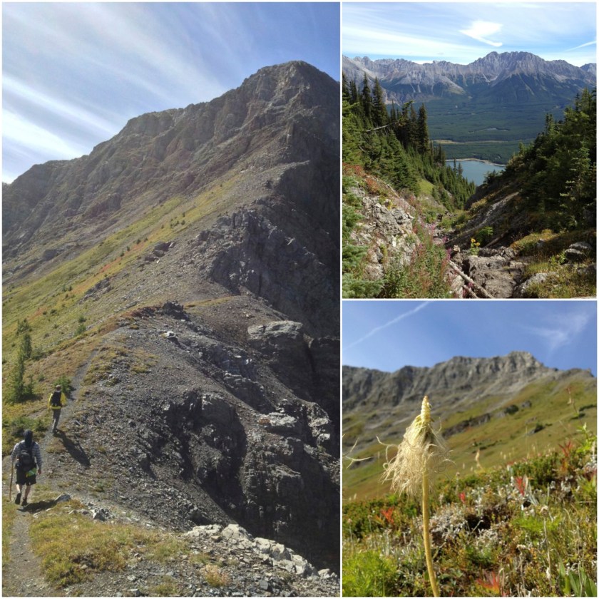
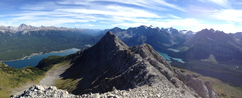
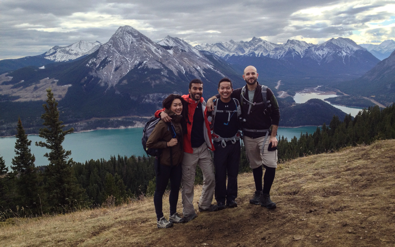
On Sunday, Robin, Lily, Robbie and I decided to go hiking. We originally planned on Forget-Me-Not ridge, but after reading about crossing a river and possibly getting wet, we opted for the Barrier Lake Lookout (also known as Prairie View Lookout). We all gathered into one car and headed west.
Once we started hiking, we realized how warm it was for a hike! We were prepared for cold, windy weather but instead it was sunny and quite warm. The incline for the hike wasn’t too steep and we made a gradual ascent for almost two hours before reaching the first lookout. The view was gorgeous! For (fairly) little effort, what an amazing place to be. We sat and ate lunch before making our way back down. We decided to head back down from the first lookout instead of proceeding to the fire lookout. I guess we just wanted to keep it super leisurely. The good thing about this hike is that it seems very doable in the winter, so I anticipate a return trip… at which point, yes, we will make it to the summit!
This hike brought back some memories for me. It was in 2009 or 2010 when I joined my first Meetup group, and I ended up doing this same hike. It was the first meetup I had attended. The difference back then is that I knew no one and hiked in a group of 30 people, which including some interesting characters. Even though I’m surrounded by great people, it reminded me that I miss meeting new people, as I find myself not doing that very often anymore. Maybe it’s time to resume the Meetup outings once again…
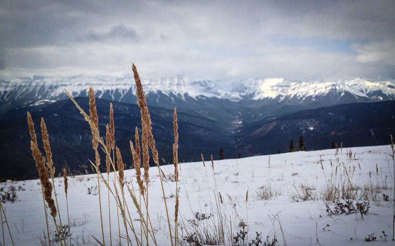
So on Sunday, a few of us headed out to Bragg Creek to hike Nihahi. As we drove, we noticed that there is so much snow in the mountains! A huge part of me is bummed that summer hiking is over; however, I’m super pumped for getting out just as much this winter. Traditionally, I’ve been low-key during the winter, but this year, I’m hoping for lots of winter walks, snowshoeing, nordic skiing and snowboarding. The 8 months with fly by in no time!
We made the last minute decision to hike Prairie Mountain instead. It’s generally a safe bet, snow or no snow, and it’s always guaranteed to have other hikers powering up the mountain. We made it to the top, enjoyed some lunch on the surprisingly windless summit, and then headed back down. Maybe it was the cold, but we were all exhausted afterwards. On this Thanksgiving weekend, I had so much to be thankful for. Among them, and I’ve said it before: I’m thankful for living so close to the mountains with the ability and capability to hike with people near and dear to me. 🙂
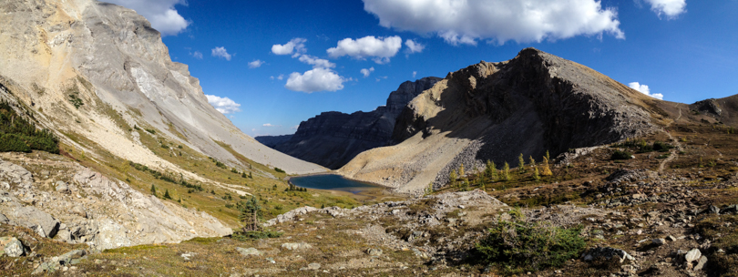
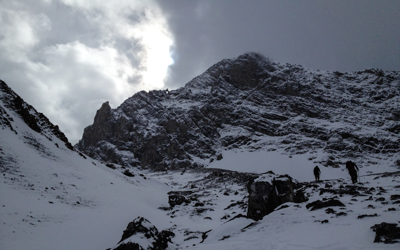
After months of being closed, part of the Highwood finally opened up! The flood had really damaged the area, and a quick google search online will show the destruction that occurred. I thought that the Highwood would be closed for the rest of the season, but nope! So when Jess asked if I wanted to go hiking on Sunday (which, of course, I did), I knew the Highwood would be an awesome area to go. With the larches turning colour, it was going to be beautiful. After considering a few choices (Pocaterra Ridge, Wasootch Peak), I suggested hiking to Grizzly Col at the Pocaterra Cirque.
What I did not count on, though, was the winter. Oh Calgary and the mountains… how much I dislike winter at times, though the snow makes the mountains look so pretty. I guess I was just expecting a little while longer to enjoy our 1-week fall. Snow came early in the mountains, and as we drove on the Highwood Pass toward the parking lot, our altitude continued to rise. Before we knew it, there was snow on the ground and lots in the mountains around us. That didn’t stop Jess, Dave and I from hiking though.
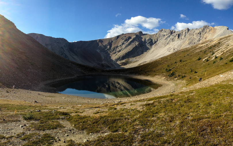
As expected, Pocaterra Cirque was so pretty, especially with all of the golden larches covered by snow. I really love this area, and as long as I’m in Calgary, I will make it a point to hike in the Highwood at least once each fall. After taking photos and stopping to eat lunch, we pressed onward. Mount Tyrwhitt and the rock arch loomed in front. We would not be ascending this mountain, but heading to the pass overlooking the continental divide. Grizzly Col (which I believe is the mountain to the left of the pass) looked quite snow-covered, so the plan was to assess that climb once we arrived at the pass. But as we ascended, the wind became fierce and at times was so strong that it stopped us in our tracks. Thank goodness I was prepared with my winter gear- ‘crampons’, gaiters, my alpine jacket, a hat and gloves. We weren’t all as prepared, and the wind was a bit concerning. In addition, the clouds were dark. Fearing a storm and potential white-out conditions, we opted to head back shortly before reaching the pass. Safety first!… (which is a motto I repeated throughout the weekend after the cougar incident). Like I mentioned, there will always be next time.
Highlights of the hike (other than time spent hiking with friends, of course…): hiking in the snow! I enjoy winter hiking and it’s something I want to do more of. So step 1- take an avalanche safety course :). The other highlight: crossing paths with wildlife! Not bears or cougars or Rocky Mountain sheep this time… but three quails. So cute.
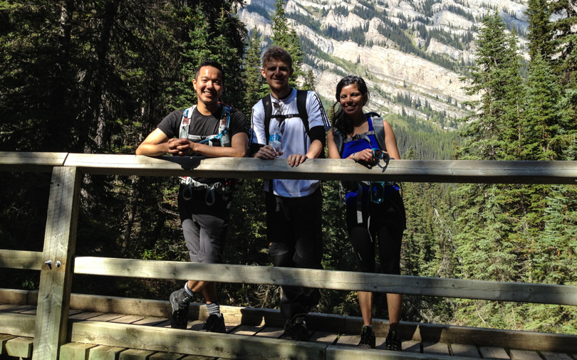
This hiking season has been about the “Classics“. In previous years, I was determined to “bag peaks”, or hit as many summits via scrambling as I could. But this year was a bit more tame. I opted for a more hiking approach: to spend lots of time in the outdoors, hike among different scenery and locations, and try to enjoy some of the hikes that Banff and Lake Louise have to offer. Earlier in the season, I’ve ventured to the Lake Agnes and Plain of Six Tea houses, hiked around Tunnel Mountain to the hoodoos in Banff, and got completely lost on the Cory Pass and Mount Edith Circuit. This past weekend, Shari, Bjorn and I would hike to Bourgeau Lake and Harvey Pass, which is another classic hike in Banff National Park.
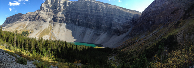
About 8 km west of Banff is the Bourgeau turn off. We parked, geared up, and began the hike. It was a late start, but we were in no rush. The first few kilometres through the forests on a well-travelled path seemed like it went on forever, but it was worth the trek to Bourgeau Lake. The backdrop of Mount Bourgeau was stunning! We plugged onward, ascending the rocky path toward Harvey Lake and the pass.
The section between Bourgeau Lake and Harvey Pass was gorgeous! Little waterfalls; green trees with golden grass and shimmering tarns lined the path toward the pass. Once we arrived, the view was beautiful. In the distance, Mount Assiniboine rose high into the sky. To our left, Mount Bourgeau taunted us, since it was too late in the afternoon to begin the summit ascent. We could see Sunshine Road and the gondola to the top of the mountain, which was crazy to see in the summer. I wonder what hikes are in that area! It was a long trip back to the car but the day trek was well worth it. The weather was beautiful and the company was great- ingredients for an awesome hiking day.
The only not so great thing? The black liquorice candies that Bjorn brought. Apparently they love them in Denmark, especially the salty kind. Thanks for sharing, Bjorn, but my palette was not ready for such an acquired taste!
Stats:
Start: 12:40 pm
End: 7:40 pm
Distance: ~ 19.8 km
Elevation gain: 1025 m
En route to Bourgeau LakeBourgeau Lake with Mount Bourgeau in the backgroundAscending to Harvey PassView of an unnamed lake and the path to Harvey PassAscending to Harvey Pass
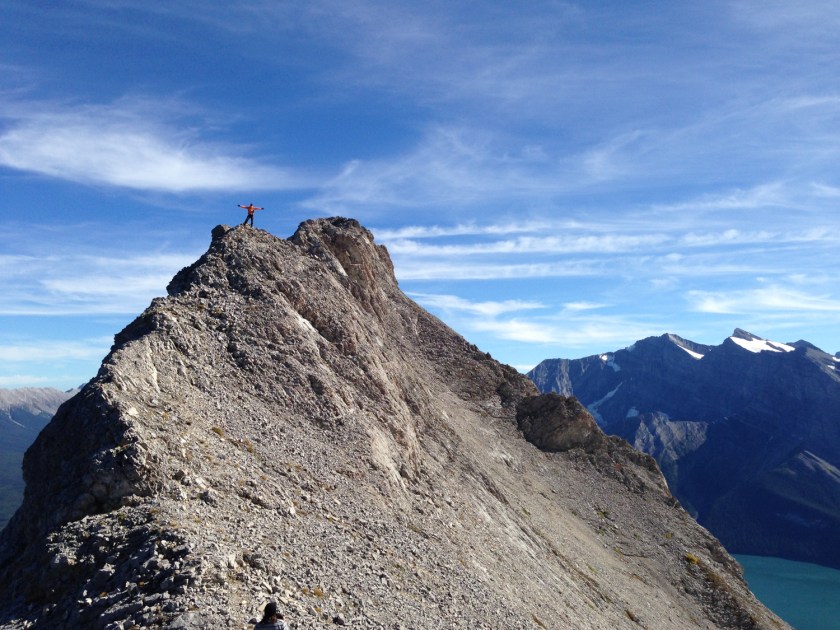
Dan and I approaching the south peak of Mount Indefatigable
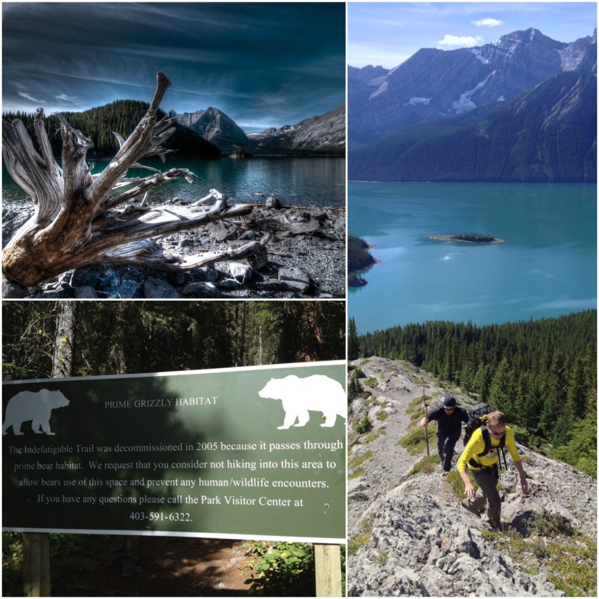
Mount Indefatigable.
I can’t remember when I learned about this hike, but ever since I was informed of its epic-ness, I’ve wanted to conquer it. That was a couple of years ago. I remember saying to Dan last year that I had a good hike in mind, but winning the Big Mountain Challenge introduced other mountains to climb. Fast forward to this past weekend. I knew Dan and Aidan wanted a good hike. Better than good. An epic show-stopper, in fact. I also wanted a new mountain summit under my belt. Indefatigable was a clear choice.
It’s decommissioned… but onward!
Before Saturday, I called the Kananaskis Visitor’s Centre to inquire about Indefatigable. It turns out the trail was decommissioned back in 2005. Did that mean we shouldn’t hike it? According to the guide, it’s definitely hike-able. Due to high grizzly activity in the area, the trail was constantly being closed when it was an official Kananaskis trail. Now that it’s decommissioned, it’s hike-at-your-own-risk. Thankfully the trail is extremely well travelled. So on Saturday, we were up early and made our way to the North Interlakes parking lot in Peter Lougheed Provincial Park with one simple goal: Conquer Mount Indefatigable. (Spoiler alert: No, we didn’t encounter any grizzlies thank goodness, but I was very much expecting that this would be the first time I would cross paths with one while hiking. Phew!)
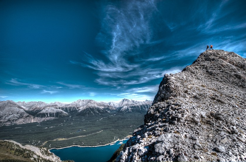
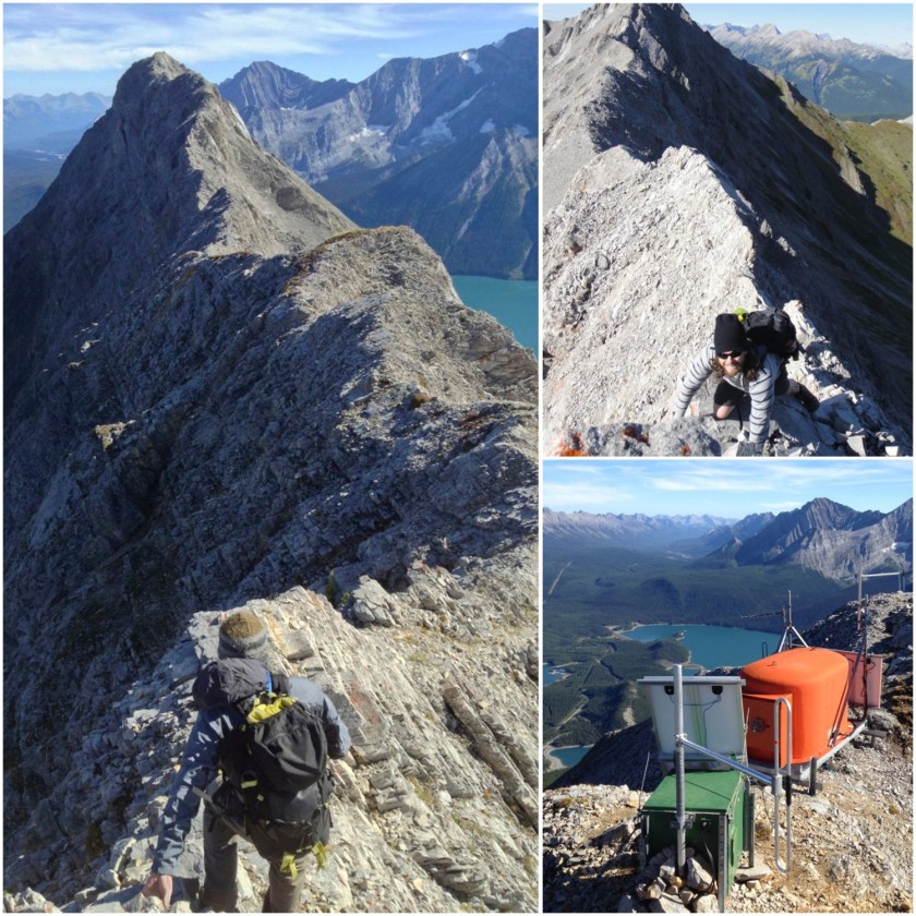
Absolutely gorgeous views of the Kananaskis Lakes
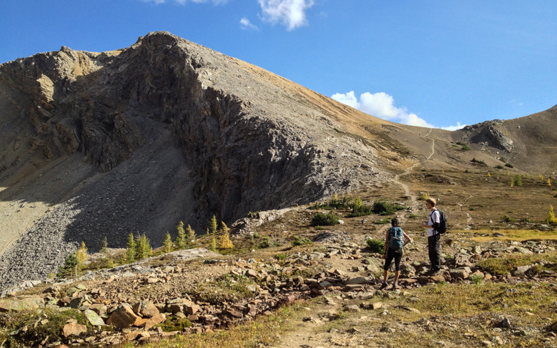
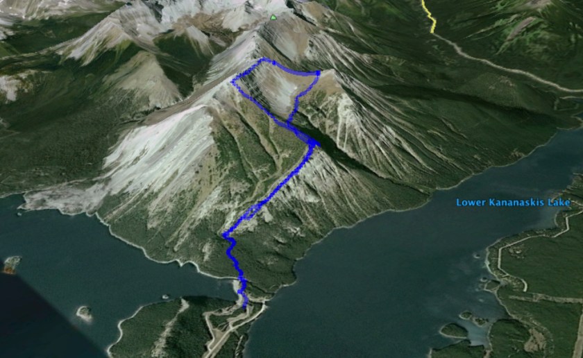
Mount Indefatigable has two peaks: the popular south peak, and the more difficult scramble to the north peak. An amazing ridge walk connects the two. When we started the trek, I thought we’d ascend to the south peak. We quickly emerged from the tree line to absolutely incredible views of the Kananaskis Lakes on either side. Mountains stretched far in the distance. We had hiked less than an hour and we were awe-struck. The weather was perfect that day too. Perhaps the giddiness helped boost our confidence. Or perhaps we were overzealous. Either way, we decided: Let’s just do the north peak and traverse the ridge! It was still early in the day, so why not?!
Wowza.
Here’s the thing: Alan Kane rates the north peak and traverse as a difficult scramble. According to his rating system, difficult scrambles require much handholding; steep, loose and exposed sections; smooth and down-sloping rocks; and risks of falling to your death. Up until Saturday, I had never completed a difficult Alan Kane scramble. Despite not having helmets for head protection, we decided to go for it. Smart? Not at all. Live and learn: a helmet is an upcoming purchase. But I’m glad we pushed through because it ended up being one of the most difficult and thrilling scrambles I’ve done in the Rockies. And boy had I been itching for a good scramble all season.
Approaching the north summit. Sketchy!
We trekked onward through forests while looking behind us at the amazing views. There were bear prints and evidence of ungulates (which I think were from the mountain goats we spotted!). We passed a dried up tarn and stopped for lunch right before the scramble to the north peak. To say that the scramble was sketch is a bit of an understatement. Dan, Aidan and I were in full concentration mode. A misstep could cause rocks to dislodge, and we did not want to be sliding down the mountain. Thankfully there was no one beneath us as Aidan accidentally sent rocks flying down the mountain. It also didn’t help that we took a wrong turn somewhere (or so we think). Hand-over-hand climbing went on for what seemed like a long time, but eventually we all made it to the summit. There would be no falling to our deaths on this mountain.
After surviving the moderate/difficult scramble, we were greeted with an amazing sight.
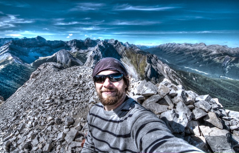
The views were absolutely incredible! I’ve hiked a lot of mountains, and I would rank the summit view in the top three, along with Mounts Sparrowhawk and Tyrwhitt. Maybe Eiffel too. We sat there for a while and took it all in. We also needed a rest- that scramble was intense! The traverse to the south peak was not nearly as scary as the ascent. In fact, I would say it wasn’t scary at all. Even though there were moments of crazy exposure and the ridge was narrow, there’s something amazing and oddly comforting about having steady footing on the ridge while the mountain drops on either side. In terms of ridge walks, this ranks highly along with Tent Ridge and Pocaterra Ridge, but takes the cake in terms of exposure and risk of falling. So much fun!
Traversing the ridgeMaking our way to the south peak
We snacked again at the South peak, and after remarking on how amazing the traverse had been, we made our descent. The views of the Kananaksis Lakes and surrounding mountains were just as amazing the second time around, now with different shadows and colours cast by the setting sun. The day ended 8 hours after we began, and the three of us were all smiles, extremely happy with our accomplishment. There were a lot of crazy awesome moments while conquering Mount Indefatiable… but what was the craziest thing I learned during the hike?

 On Sunday, Robin, Lily, Robbie and I decided to go hiking. We originally planned on Forget-Me-Not ridge, but after reading about crossing a river and possibly getting wet, we opted for the Barrier Lake Lookout (also known as Prairie View Lookout). We all gathered into one car and headed west.
 So on Sunday, a few of us headed out to Bragg Creek to hike Nihahi. As we drove, we noticed that there is so much snow in the mountains! A huge part of me is bummed that summer hiking is over; however, I’m super pumped for getting out just as much this winter. Traditionally, I’ve been low-key during the winter, but this year, I’m hoping for lots of winter walks, snowshoeing, nordic skiing and snowboarding. The 8 months with fly by in no time!
 After months of being closed, part of the Highwood finally opened up! The flood had really damaged the area, and a quick google search online will show the destruction that occurred. I thought that the Highwood would be closed for the rest of the season, but nope! So when Jess asked if I wanted to go hiking on Sunday (which, of course, I did), I knew the Highwood would be an awesome area to go. With the larches turning colour, it was going to be beautiful. After considering a few choices (Pocaterra Ridge, Wasootch Peak), I suggested hiking to Grizzly Col at the Pocaterra Cirque.
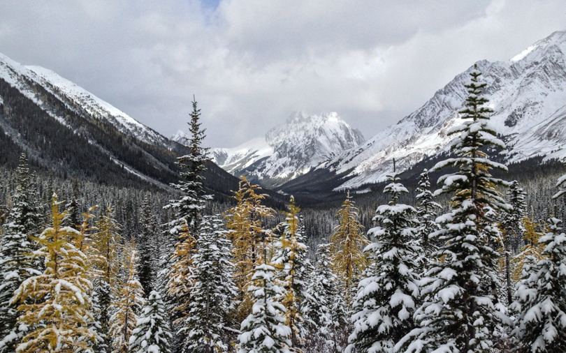 As expected, Pocaterra Cirque was so pretty, especially with all of the golden larches covered by snow. I really love this area, and as long as I’m in Calgary, I will make it a point to hike in the Highwood at least once each fall. After taking photos and stopping to eat lunch, we pressed onward. Mount Tyrwhitt and the rock arch loomed in front. We would not be ascending this mountain, but heading to the pass overlooking the continental divide. Grizzly Col (which I believe is the mountain to the left of the pass) looked quite snow-covered, so the plan was to assess that climb once we arrived at the pass. But as we ascended, the wind became fierce and at times was so strong that it stopped us in our tracks. Thank goodness I was prepared with my winter gear- ‘crampons’, gaiters, my alpine jacket, a hat and gloves. We weren’t all as prepared, and the wind was a bit concerning. In addition, the clouds were dark. Fearing a storm and potential white-out conditions, we opted to head back shortly before reaching the pass. Safety first!… (which is a motto I repeated throughout the weekend after the cougar incident). Like I mentioned, there will always be next time.